MyTopo
Allard Montana US Topo Map
Couldn't load pickup availability
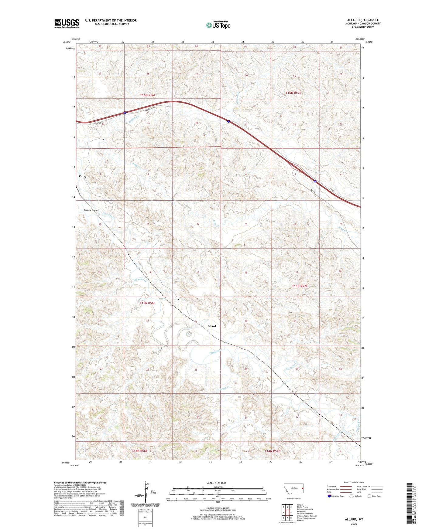
2024 topographic map quadrangle Allard in the state of Montana. Scale: 1:24000. Based on the newly updated USGS 7.5' US Topo map series, this map is in the following counties: Dawson. The map contains contour data, water features, and other items you are used to seeing on USGS maps, but also has updated roads and other features. This is the next generation of topographic maps. Printed on high-quality waterproof paper with UV fade-resistant inks.
Quads adjacent to this one:
West: Glendive
Northwest: Stipek
North: Belle Prairie
Northeast: Cluster Buttes NW
East: Cluster Buttes SW
Southeast: Hodges
South: Twin Forks Reservoir
Southwest: Upper Magpie Reservoir
This map covers the same area as the classic USGS quad with code o47104a5.
Contains the following named places: 15N56E12BBBA01 Well, 15N56E14CDBA01 Well, 15N56E23DDCB01 Well, 15N57E04DCCA01 Well, 15N57E06ADBB01 Well, 15N57E18ADDA01 Well, 15N57E19CCAD01 Well, 16N56E34BDCB01 Well, Allard, Allard Post Office, Allard School, Burning Coal Mine, Frank Creek, Griffith Creek, Hodges Creek, Hot Bar Number 1 Dam, Kinney Coulee, Krug Creek