MyTopo
Holland Lake Montana US Topo Map
Couldn't load pickup availability
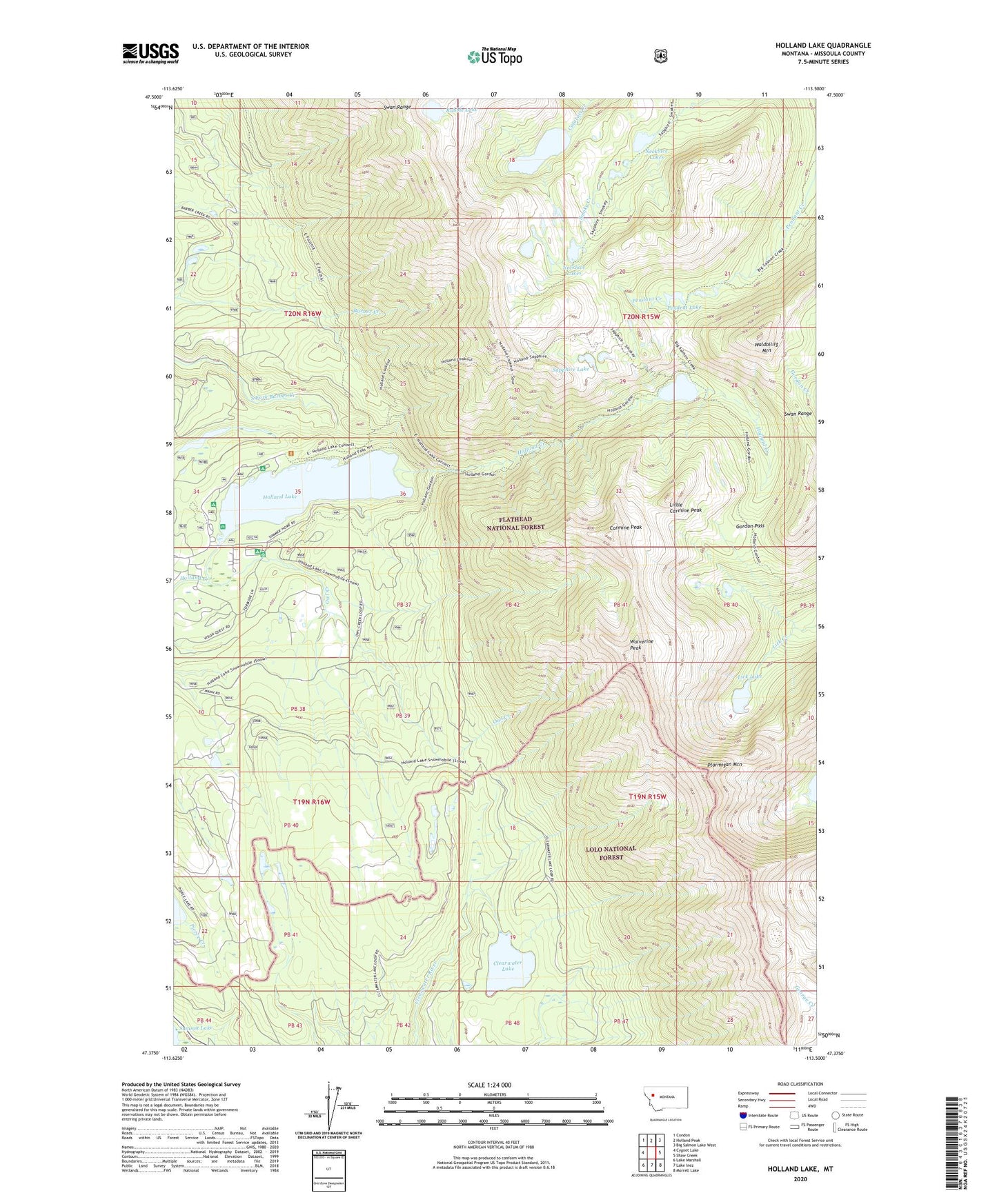
2020 topographic map quadrangle Holland Lake in the state of Montana. Scale: 1:24000. Based on the newly updated USGS 7.5' US Topo map series, this map is in the following counties: Missoula. The map contains contour data, water features, and other items you are used to seeing on USGS maps, but also has updated roads and other features. This is the next generation of topographic maps. Printed on high-quality waterproof paper with UV fade-resistant inks.
Quads adjacent to this one:
West: Cygnet Lake
Northwest: Condon
North: Holland Peak
Northeast: Big Salmon Lake West
East: Shaw Creek
Southeast: Morrell Lake
South: Lake Inez
Southwest: Lake Marshall
Contains the following named places: 19N16W03ABCD01 Well, 19N16W03ACAB01 Well, Carmine Peak, Clearwater Lake, Gordon Pass, Holland Falls National Recreation Trail, Holland Lake, Holland Lake Campground, Lick Lake, Little Carmine Peak, Necklace Lakes, Owl Creek, Owl Creek Packer Camp, Pendent Lake, Ptarmigan Mountain, Rubble Lake, Sapphire Lake, Upper Holland Lake, Waldbillig Mountain, Wolverine Peak, Woodward Lake