MyTopo
Hollenbeck Draw Montana US Topo Map
Couldn't load pickup availability
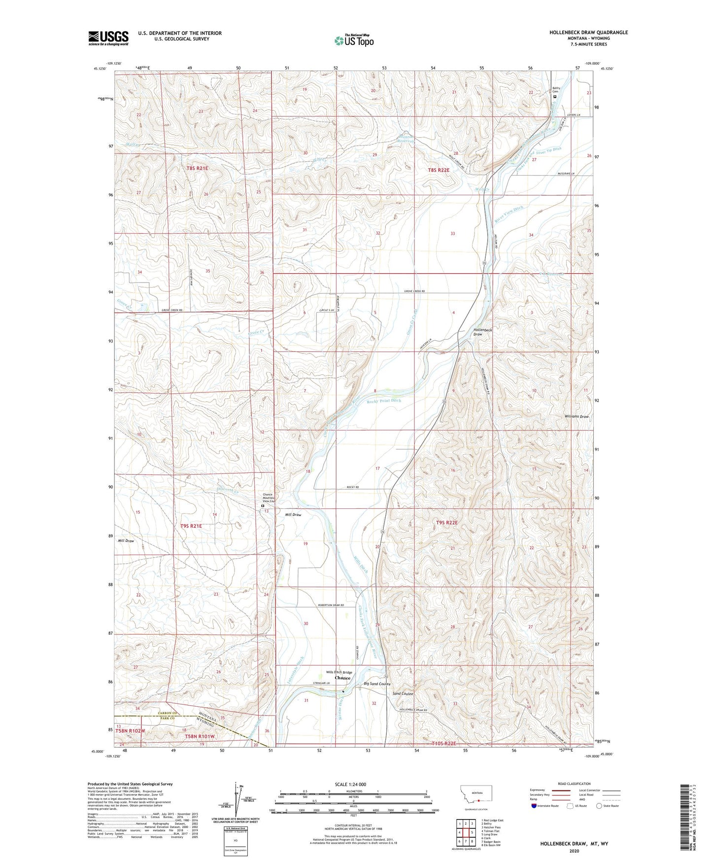
2024 topographic map quadrangle Hollenbeck Draw in the state of Montana. Scale: 1:24000. Based on the newly updated USGS 7.5' US Topo map series, this map is in the following counties: Carbon, Park. The map contains contour data, water features, and other items you are used to seeing on USGS maps, but also has updated roads and other features. This is the next generation of topographic maps. Printed on high-quality waterproof paper with UV fade-resistant inks.
Quads adjacent to this one:
West: Tolman Flat
Northwest: Red Lodge East
North: Belfry
Northeast: Hatcher Pass
East: Long Draw
Southeast: Elk Basin NW
South: Badger Basin
Southwest: Clark
Contains the following named places: 08S22E27ACCC01 Well, 08S22E28DDAD01 Well, 08S22E32DDAD01 Well, 08S22E34CCCB01 Well, 09S22E05DBBC01 Well, 09S22E17ACCD01 Well, 09S22E19ADBD01 Well, 09S22E20CDCD01 Well, 09S22E30BADD01 Well, 09S22E31ADAA01 Well, 59008, Belfry Cemetery, Big Reservoir Dam, Big Sand Coulee, Bridger Bend Fishing Access Site, Chance, Chance Mountain View Cemetery, Chance Post Office, Chance School, Clarks Fork and Silver Tip Ditch, Dilworth Creek, Doctor Ditch, Grove Creek, Grove Creek Canal, Hollenbeck Draw, Interstate Ditch, Limberger Dam, Mill Draw, Monroe Reservoir, Riverview Post Office, Riverview School, Rocky Point Ditch, Sand Coulee, Sirrine Ditch, V O Reservoir, Wills Ditch, Wills Ditch Bridge, Wolf Creek