MyTopo
Long Draw Montana US Topo Map
Couldn't load pickup availability
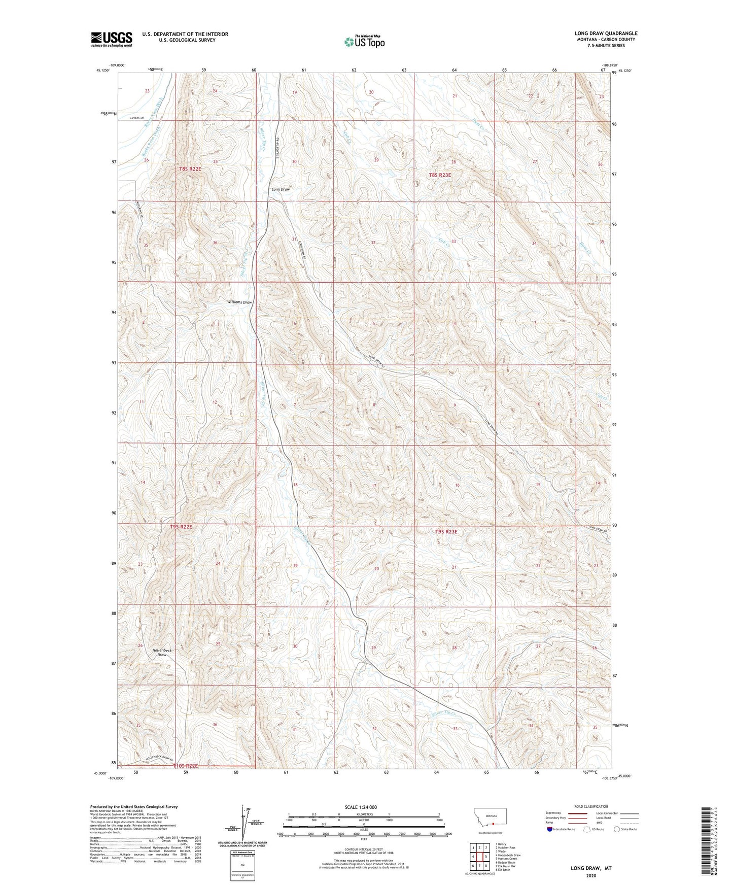
2024 topographic map quadrangle Long Draw in the state of Montana. Scale: 1:24000. Based on the newly updated USGS 7.5' US Topo map series, this map is in the following counties: Carbon. The map contains contour data, water features, and other items you are used to seeing on USGS maps, but also has updated roads and other features. This is the next generation of topographic maps. Printed on high-quality waterproof paper with UV fade-resistant inks.
Quads adjacent to this one:
West: Hollenbeck Draw
Northwest: Belfry
North: Hatcher Pass
Northeast: Wade
East: Hunters Creek
Southeast: Elk Basin
South: Elk Basin NW
Southwest: Badger Basin
Contains the following named places: 08S22E23DCCC01 Well, 09S23E18BBDA01 Well, Elk Basin Oil Field, High Well, Higham Well, Long Draw, River View Ditch, Williams Draw