MyTopo
Belfry Montana US Topo Map
Couldn't load pickup availability
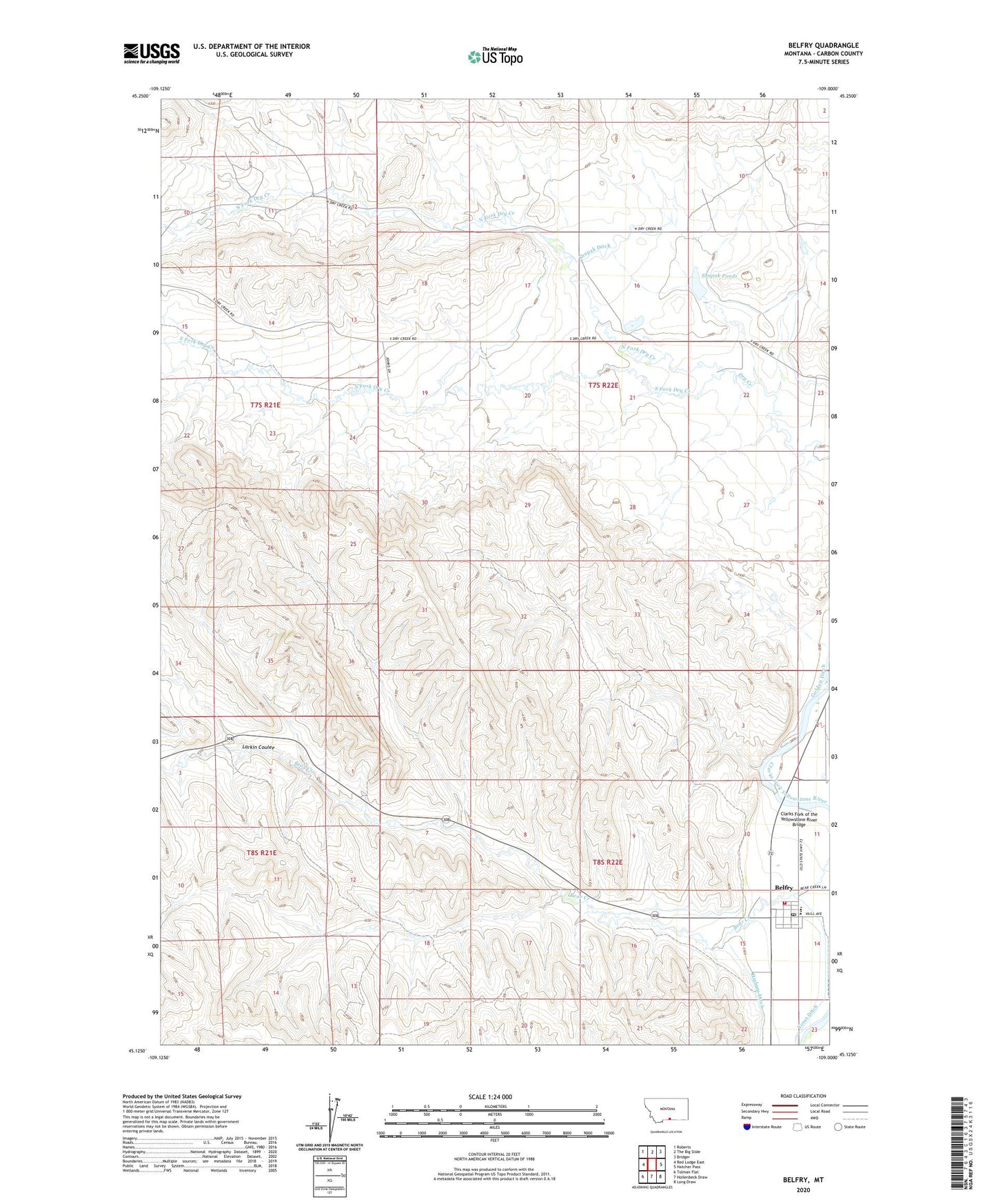
2024 topographic map quadrangle Belfry in the state of Montana. Scale: 1:24000. Based on the newly updated USGS 7.5' US Topo map series, this map is in the following counties: Carbon. The map contains contour data, water features, and other items you are used to seeing on USGS maps, but also has updated roads and other features. This is the next generation of topographic maps. Printed on high-quality waterproof paper with UV fade-resistant inks.
Quads adjacent to this one:
West: Red Lodge East
Northwest: Roberts
North: The Big Slide
Northeast: Bridger
East: Hatcher Pass
Southeast: Long Draw
South: Hollenbeck Draw
Southwest: Tolman Flat
This map covers the same area as the classic USGS quad with code o45109b1.
Contains the following named places: 08S22E15ADBC01 Well, 59007, Belfry, Belfry Post Office, Belfry Rural Fire District 9, Belfry School, Belfry United Methodist Church, Carbon County, Clarks Fork of the Yellowstone River Bridge, Higham Ditch, Larkin Coulee, North Fork Dry Creek, Olivers, Saint Johns Lutheran Church, Shupak Ditch, Shupak Number 1 Dam, Shupak Number 2 Dam, Shupak Ponds, South Fork Dry Creek, Sunnyside School, The Church of Jesus Christ of Latter Day Saints, Youst Ditch