MyTopo
Hatcher Pass Montana US Topo Map
Couldn't load pickup availability
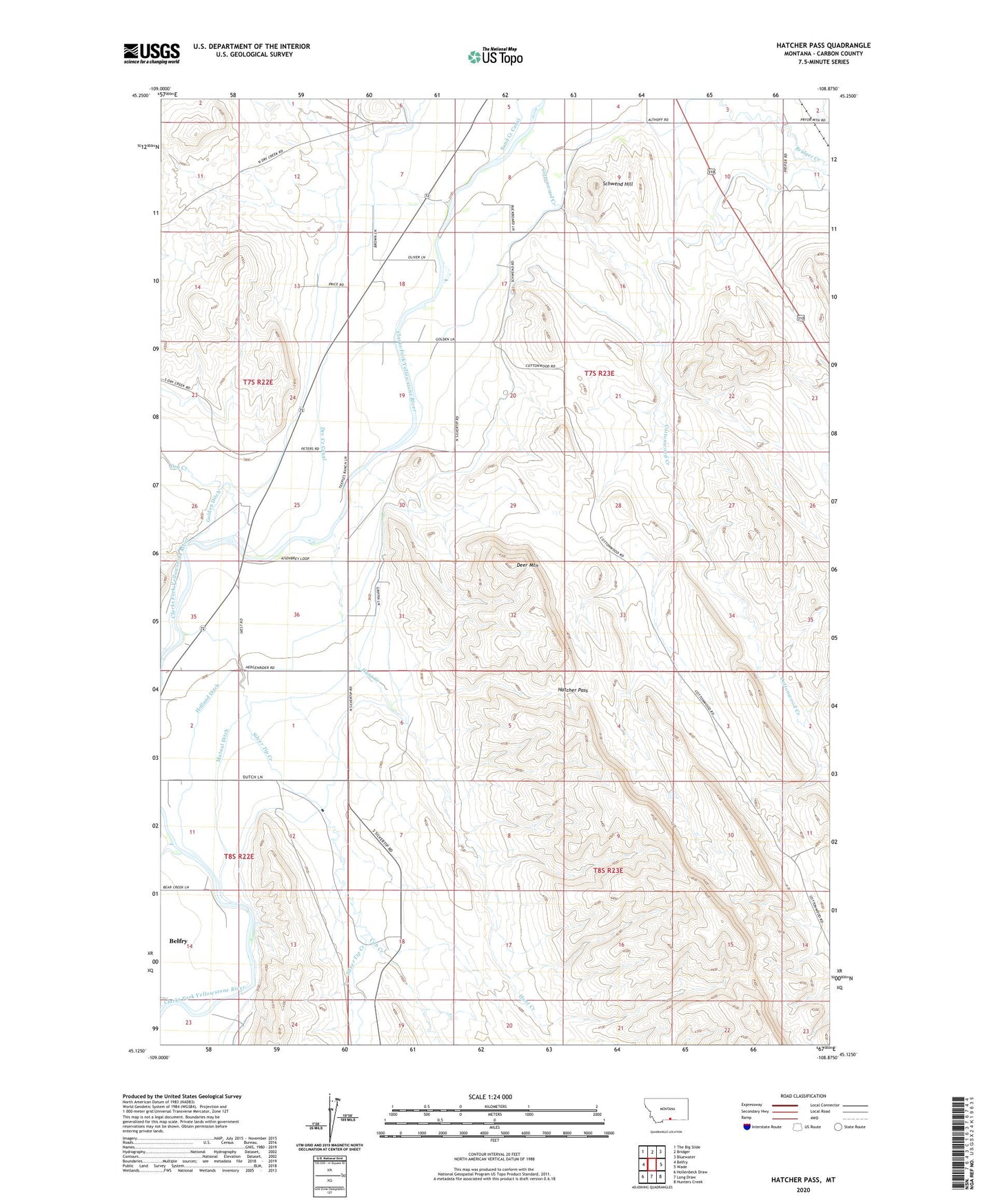
2024 topographic map quadrangle Hatcher Pass in the state of Montana. Scale: 1:24000. Based on the newly updated USGS 7.5' US Topo map series, this map is in the following counties: Carbon. The map contains contour data, water features, and other items you are used to seeing on USGS maps, but also has updated roads and other features. This is the next generation of topographic maps. Printed on high-quality waterproof paper with UV fade-resistant inks.
Quads adjacent to this one:
West: Belfry
Northwest: The Big Slide
North: Bridger
Northeast: Bluewater
East: Wade
Southeast: Hunters Creek
South: Long Draw
Southwest: Hollenbeck Draw
This map covers the same area as the classic USGS quad with code o45108b8.
Contains the following named places: 07S22E23DDBB01 Well, 07S22E25DDAD01 Well, 07S22E26DDDD01 Well, 07S23E06CDAA01 Well, 07S23E08CACB01 Well, 07S23E10DBBD01 Well, 07S23E15ABCD01 Well, 07S23E18ABDD01 Well, 07S23E19AACC01 Well, 07S23E29BBBB01 Well, 07S23E34ABCA01 Well, 08S22E01ADAA01 Well, 08S22E01CCDC01 Well, 08S22E02BACC01 Well, 08S22E11CDCC01 Well, Bear Creek, Belfry Census Designated Place, Cottonwood Creek, Cub Creek, Deer Mountain, Dry Creek, Dry Creek Canal, Golden, Golden Ditch, Golden Post Office, Golden School, Hatcher Pass, Holland Ditch, Hunt Creek, Jack Creek, Jennings, Mutual Ditch, New Prospect School, Schwend Hill, Shupak, Silver Tip Creek, Tucker School