MyTopo
Holzhey Reservoir Montana US Topo Map
Couldn't load pickup availability
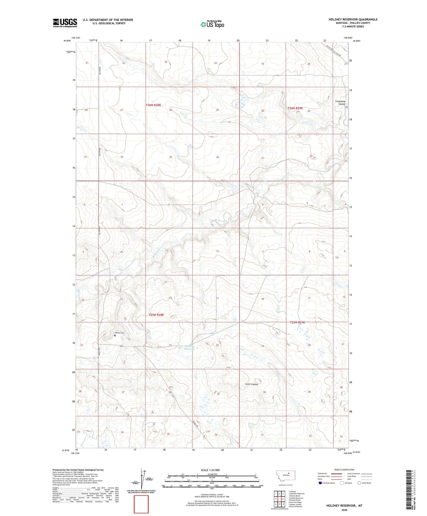
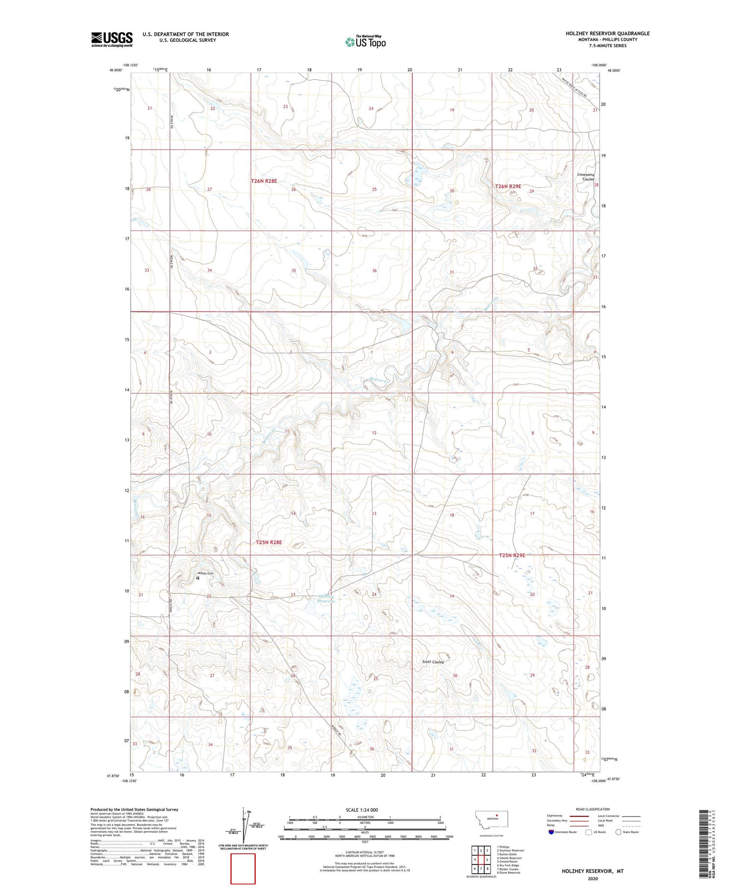
2020 topographic map quadrangle Holzhey Reservoir in the state of Montana. Scale: 1:24000. Based on the newly updated USGS 7.5' US Topo map series, this map is in the following counties: Phillips. The map contains contour data, water features, and other items you are used to seeing on USGS maps, but also has updated roads and other features. This is the next generation of topographic maps. Printed on high-quality waterproof paper with UV fade-resistant inks.
Quads adjacent to this one:
West: Veseth Reservoir
Northwest: Phillips
North: Seymour Reservoir
Northeast: Button Butte
East: Emond Ranch
Southeast: Dione Reservoir
South: Barber Coulee
Southwest: Dry Fork Ridge
Contains the following named places: 25N29E06BC__01 Well, 25N29E06BD__01 Well, 26N29E28B___01 Well, 26N29E31D___01 Well, 26N29E33BC__01 Well, Emond School, Grandview School, Holzhey Reservoir, J-5 Ranch Number 1 Dam, Lone Tree Dam, Lonesome Dam, Lonesome Post Office, Martown Veseth Number 3 Dam, Midale Cemetery, Noel Number 3 Dam, PR-147 Dam, Schoolhouse Number 3 Dam, Zenon Post Office