MyTopo
Dione Reservoir Montana US Topo Map
Couldn't load pickup availability
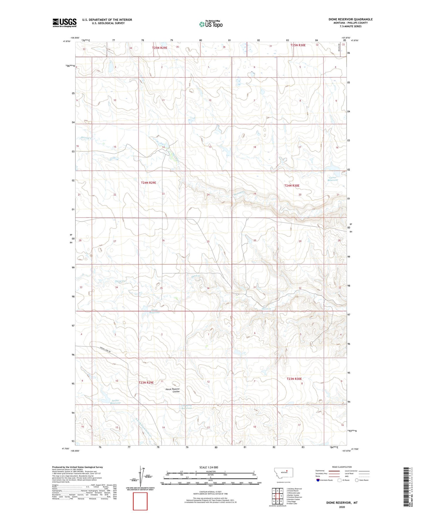
2024 topographic map quadrangle Dione Reservoir in the state of Montana. Scale: 1:24000. Based on the newly updated USGS 7.5' US Topo map series, this map is in the following counties: Phillips. The map contains contour data, water features, and other items you are used to seeing on USGS maps, but also has updated roads and other features. This is the next generation of topographic maps. Printed on high-quality waterproof paper with UV fade-resistant inks.
Quads adjacent to this one:
West: Barber Coulee
Northwest: Holzhey Reservoir
North: Emond Ranch
Northeast: Whitcomb Lake
East: Stratton Reservoir
Southeast: Indian Lake
South: Pea Ridge
Southwest: Karsten Coulee
This map covers the same area as the classic USGS quad with code o47107g8.
Contains the following named places: 23N29E15AD__01 Well, 24N29E14CBD_01 Well, 24N29E14DA__01 Well, 24N29E24BA__01 Well, 24N30E21BAC_01 Well, 24N30E32DADA01 Well, 25N29E33DDAD01 Well, Archie Reservoir, Blunt Ranch Number 3 Dam, Blunt RanchES Number 2 Dam, Carberry Dam, Carberry Reservoir, Carter Reservoir, Carters Reservoir Dam, Curly Q Dam, Dione Reservoir, Dione Reservoir Dam, Fifty Dam, First Creek, First Creek Post Office, Fourchette School, South First Creek School, Veseth and Veseth Number 1 Dam, Veseth and Veseth Number 2 Dam