MyTopo
Home Park Ranch Montana US Topo Map
Couldn't load pickup availability
Also explore the Home Park Ranch Forest Service Topo of this same quad for updated USFS data
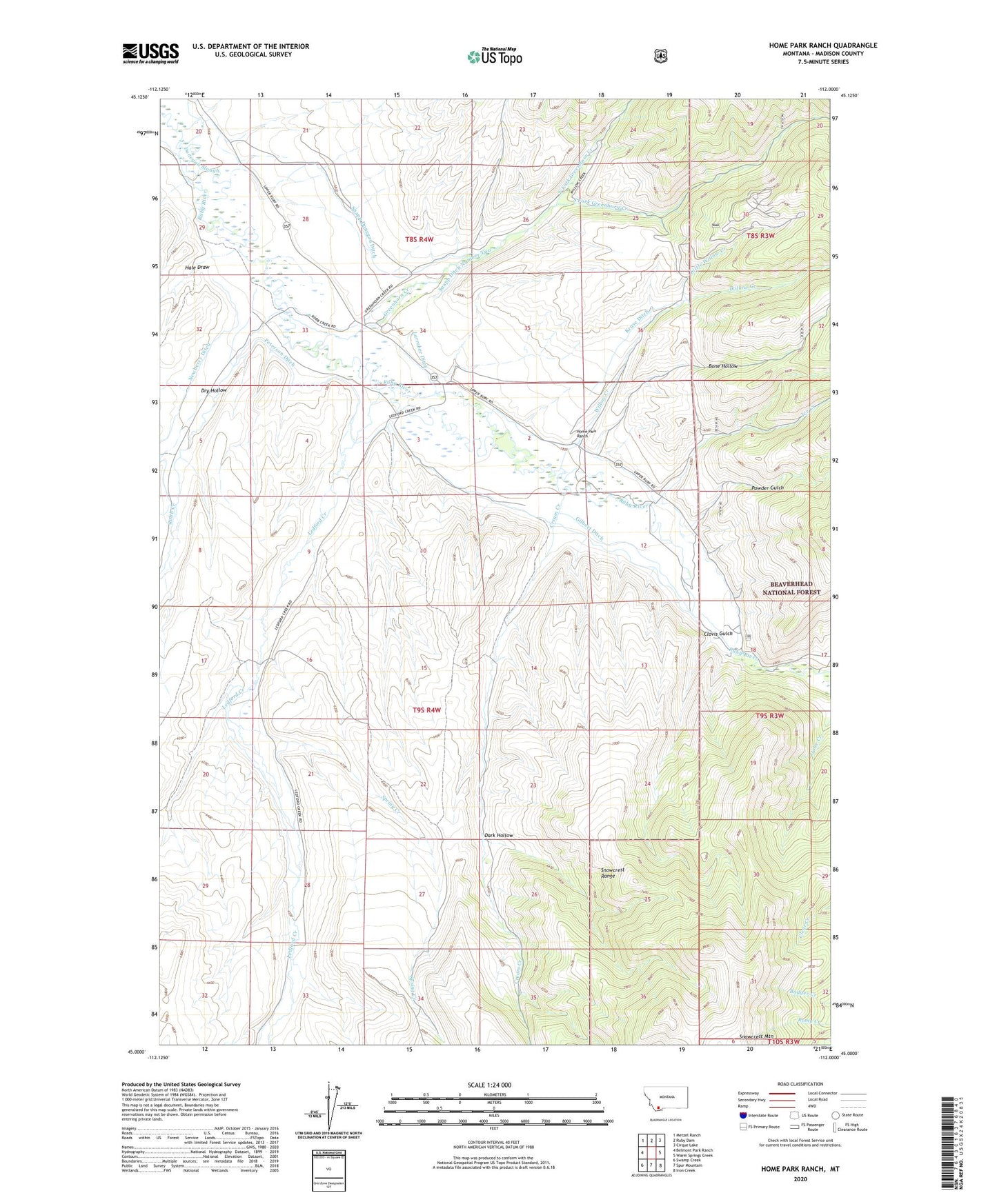
2024 topographic map quadrangle Home Park Ranch in the state of Montana. Scale: 1:24000. Based on the newly updated USGS 7.5' US Topo map series, this map is in the following counties: Madison. The map contains contour data, water features, and other items you are used to seeing on USGS maps, but also has updated roads and other features. This is the next generation of topographic maps. Printed on high-quality waterproof paper with UV fade-resistant inks.
Quads adjacent to this one:
West: Belmont Park Ranch
Northwest: Metzel Ranch
North: Ruby Dam
Northeast: Cirque Lake
East: Warm Springs Creek
Southeast: Iron Creek
South: Spur Mountain
Southwest: Swamp Creek
This map covers the same area as the classic USGS quad with code o45112a1.
Contains the following named places: 08S04W34BCC_01 Well, 09S04W01DCDD01 Well, 09S04W01DCDD02 Well, 09S04W11BAAD01 Well, 59710, Battle Ditch, Battle Ranch, Big Willow Mine, Bone Hollow, Bowman Place, Canyon Campground, Canyon Campground Mine, Clovis Gulch, Cream Creek, Dark Hollow, Donegan Slough, Dry Hollow, East Side Ditch, Garrison Cabin, Gilbert Ditch, Gilbert Ranch, Greenhorn Creek, Hale Draw, Hale Place, Home Park Ranch, Home Park School, Homepark Post Office, Ice Creek, Judge Ditch, Kruse Ditch, Larrabee Ditch, Leary Place, Ledford Creek, Leonard Place, Little Willow Creek, Newberry Ditch, North Fork Greenhorn Creek, Peterson Ditch, Peterson Ranch, Powder Gulch, Reeder Place, Robb Creek, Snapp Ditch Number Two, Snapp Donegan Ditch, Snowcrest Mountain, South Fork Greenhorn Creek, Spring Creek, Tate Place, Virginia City Division, Willow Creek