MyTopo
Warm Springs Creek Montana US Topo Map
Couldn't load pickup availability
Also explore the Warm Springs Creek Forest Service Topo of this same quad for updated USFS data
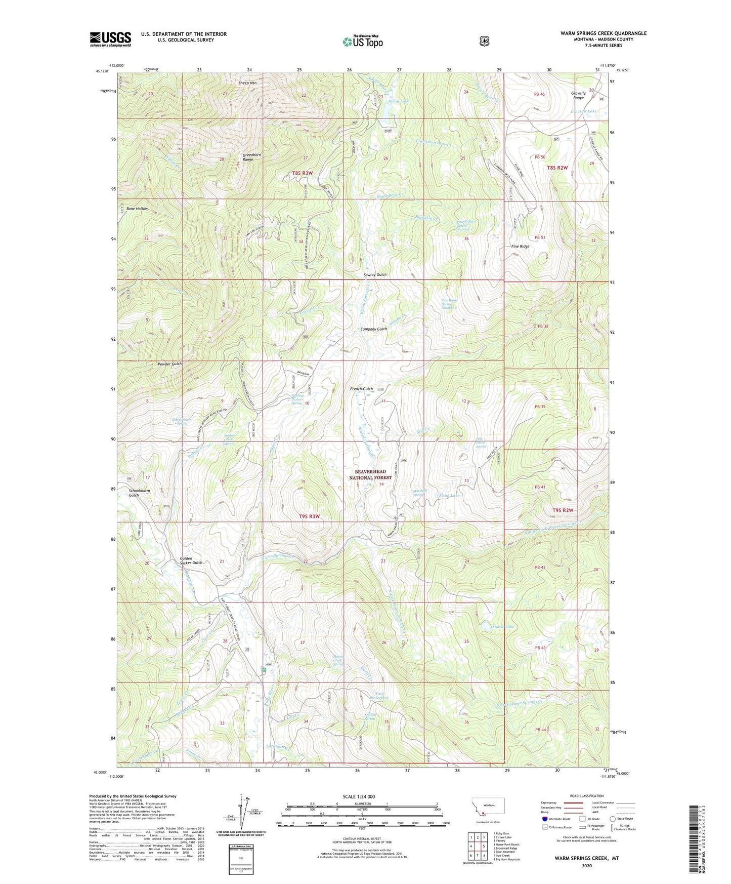
2024 topographic map quadrangle Warm Springs Creek in the state of Montana. Scale: 1:24000. Based on the newly updated USGS 7.5' US Topo map series, this map is in the following counties: Madison. The map contains contour data, water features, and other items you are used to seeing on USGS maps, but also has updated roads and other features. This is the next generation of topographic maps. Printed on high-quality waterproof paper with UV fade-resistant inks.
Quads adjacent to this one:
West: Home Park Ranch
Northwest: Ruby Dam
North: Cirque Lake
Northeast: Varney
East: Broomtail Ridge
Southeast: Big Horn Mountain
South: Iron Creek
Southwest: Spur Mountain
This map covers the same area as the classic USGS quad with code o45111a8.
Contains the following named places: Badger Creek, Black Bear Creek, Brown Bear Creek, Buckskin Creek, Cinnamon Bear Creek, Clear Creek, Company Gulch, Coyote Creek, Crockett Lake, Davis Creek, Fine Ridge, Fine Ridge Spring Number 1, Fine Ridge Spring Number 2, Fred B Utter Ranch, French Gulch, Golden Sucker Gulch, Greenhorn Range, Gumbo Creek, Holding Pasture Spring, Hudson Ranch, Jobe Creek, Lazyman Creek, Lewis Creek, Lott Creek, Marshall Spring, Martin Creek, Martin Creek Spring, Middle Fork Warm Springs Creek, Moltich Spring, Moose Lake, Pole Patch, Pole Patch Spring, Romy Lake, Sawlog Gulch, Schoolmarm Gulch, Schoolmarm Spring, Sheep Mountain, South Fork Romy Creek, South Fork Warm Springs Creek, Still Creek, Swan Lake, Tate Reservoir, Timber Creek, Timber Creek Spring, Vigilante Forest Service Station, Warm Springs Cow Camp, Warm Springs Creek, White Bear Creek