MyTopo
Belmont Park Ranch Montana US Topo Map
Couldn't load pickup availability
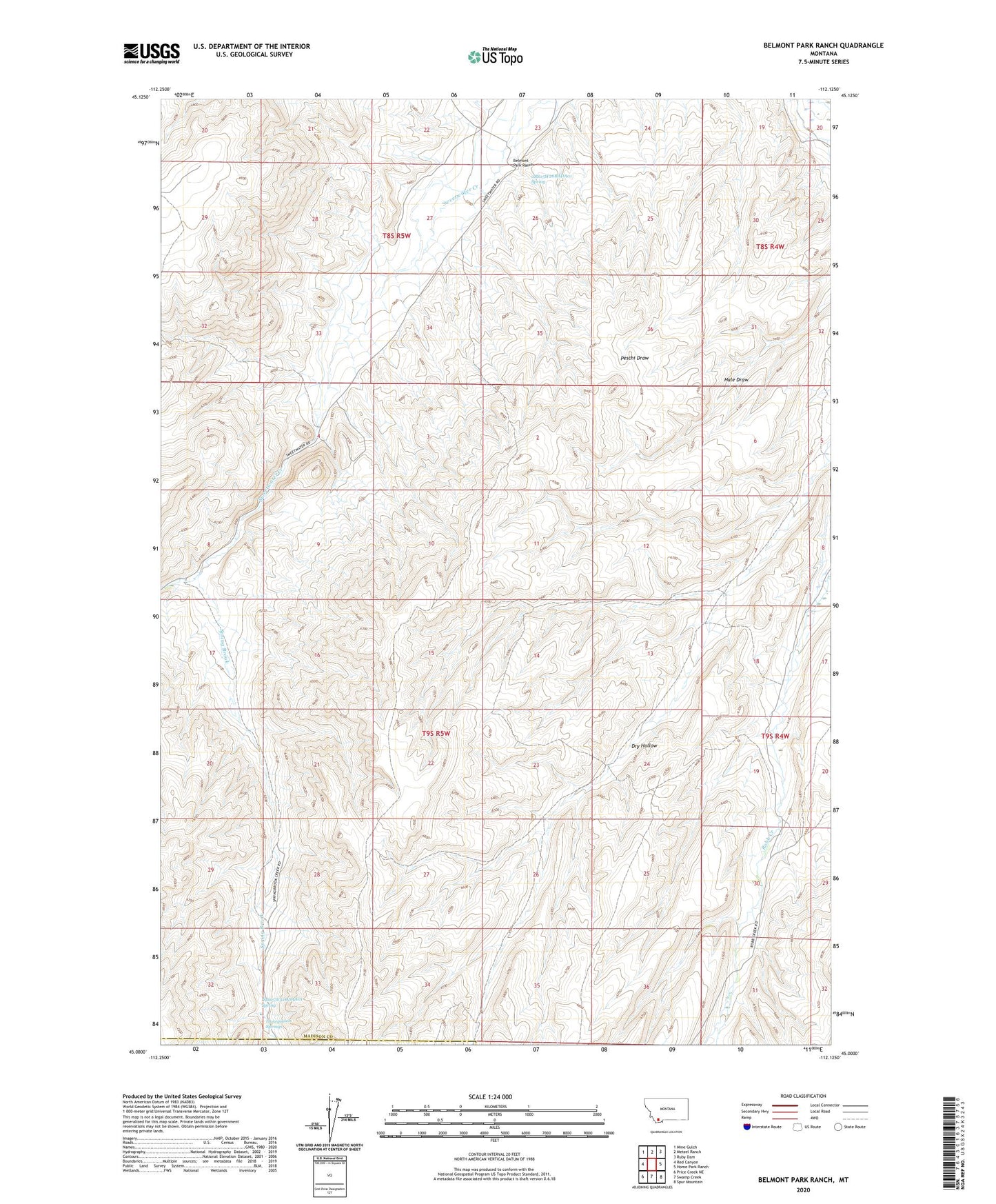
2024 topographic map quadrangle Belmont Park Ranch in the state of Montana. Scale: 1:24000. Based on the newly updated USGS 7.5' US Topo map series, this map is in the following counties: Madison, Beaverhead. The map contains contour data, water features, and other items you are used to seeing on USGS maps, but also has updated roads and other features. This is the next generation of topographic maps. Printed on high-quality waterproof paper with UV fade-resistant inks.
Quads adjacent to this one:
West: Red Canyon
Northwest: Mine Gulch
North: Metzel Ranch
Northeast: Ruby Dam
East: Home Park Ranch
Southeast: Spur Mountain
South: Swamp Creek
Southwest: Price Creek NE
This map covers the same area as the classic USGS quad with code o45112a2.
Contains the following named places: 08S05W26BADA01 Spring, 09S05W12CCDD01 Well, 09S05W32DDAA01 Spring, Belmont Park Ranch, Fries Place, Honeymoon Springs, Leyendecker Powers Ditch, Spring Brook, Spring Brook Camp, Sweet Water School, Sweetwater