MyTopo
Metzel Ranch Montana US Topo Map
Couldn't load pickup availability
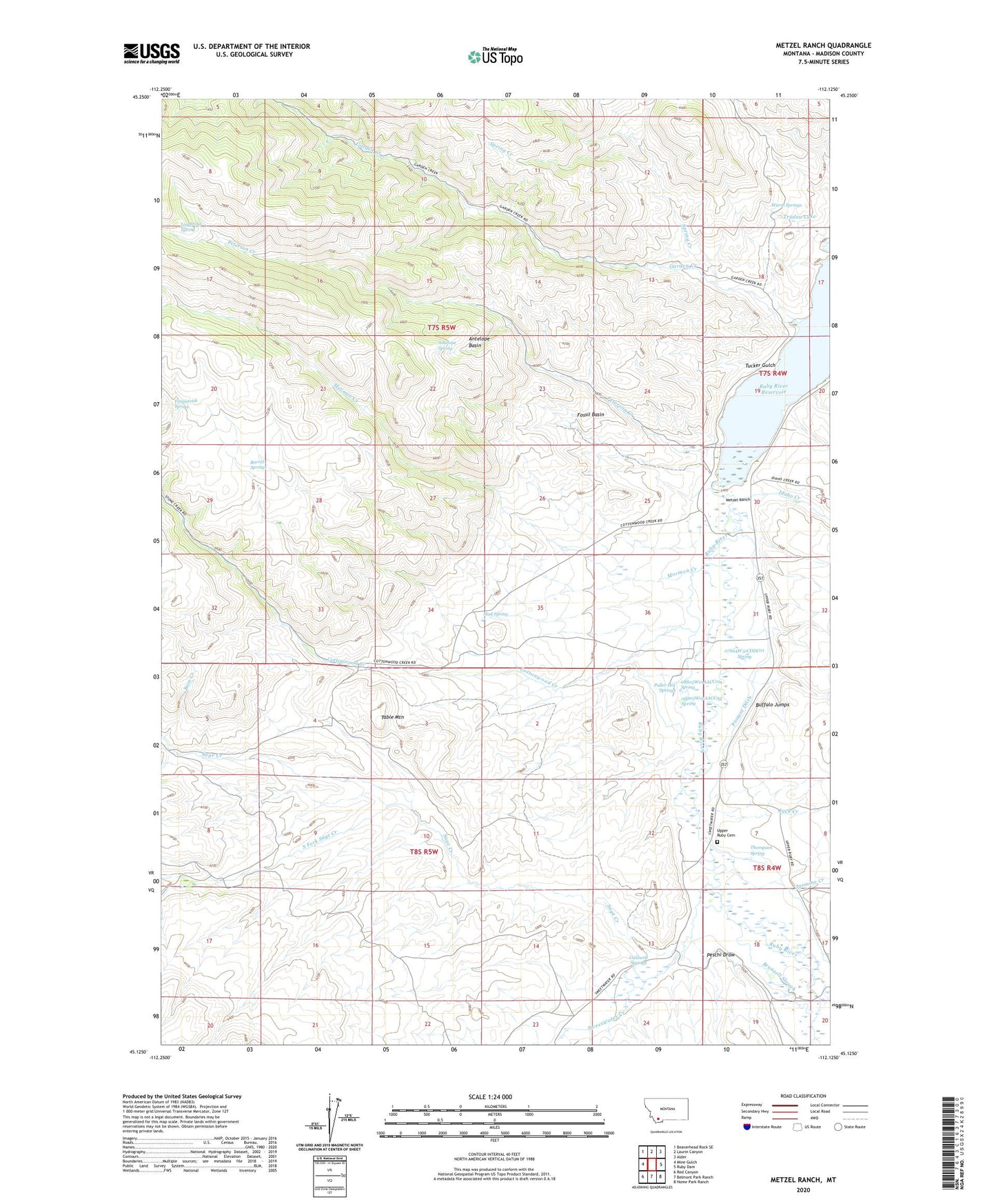
2024 topographic map quadrangle Metzel Ranch in the state of Montana. Scale: 1:24000. Based on the newly updated USGS 7.5' US Topo map series, this map is in the following counties: Madison. The map contains contour data, water features, and other items you are used to seeing on USGS maps, but also has updated roads and other features. This is the next generation of topographic maps. Printed on high-quality waterproof paper with UV fade-resistant inks.
Quads adjacent to this one:
West: Mine Gulch
Northwest: Beaverhead Rock SE
North: Laurin Canyon
Northeast: Alder
East: Ruby Dam
Southeast: Home Park Ranch
South: Belmont Park Ranch
Southwest: Red Canyon
This map covers the same area as the classic USGS quad with code o45112b2.
Contains the following named places: 07S04W31CDDC01 Spring, 07S04W31DCB_01 Well, 08S04W06ABBA01 Well, 08S05W01AACC01 Spring, 08S05W01AACC02 Spring, Antelope Basin, Antelope Spring, Ball Place, Barrel Springs, Broadhead Slough, Brunzell Slough, Buffalo Jumps, Bum Creek, Burdick Place, Caldwell Springs, Campbell Place, Cottonwood Creek, Fitzpatrick Spring, Fossil Basin, Garden Creek, Idaho Creek, Jack Creek, Jasmine Creek, Kelly Hill Mine, Kingrey Place, Leonard Place, Lightning Spring, Maloney Ranch, Metzel Ranch, Metzel West Side Ditch, Mormon Creek, Mud Spring, Peschi Draw, Peterson Creek, Peterson Creek Mine, Pioneer Ditch, Puller Hot Springs, Puller Springs Post Office, Puller Springs School, Ruby River Reservoir, Sage Creek, Slate Stone, South Fork Sage Creek, Spring Creek, Stinking Water, Sweetwater Creek, Table Mountain, Thompson Spring, Trudau Lake, Tucker Gulch, Upper Ruby Cemetery, Upper Ruby School, Warm Springs