MyTopo
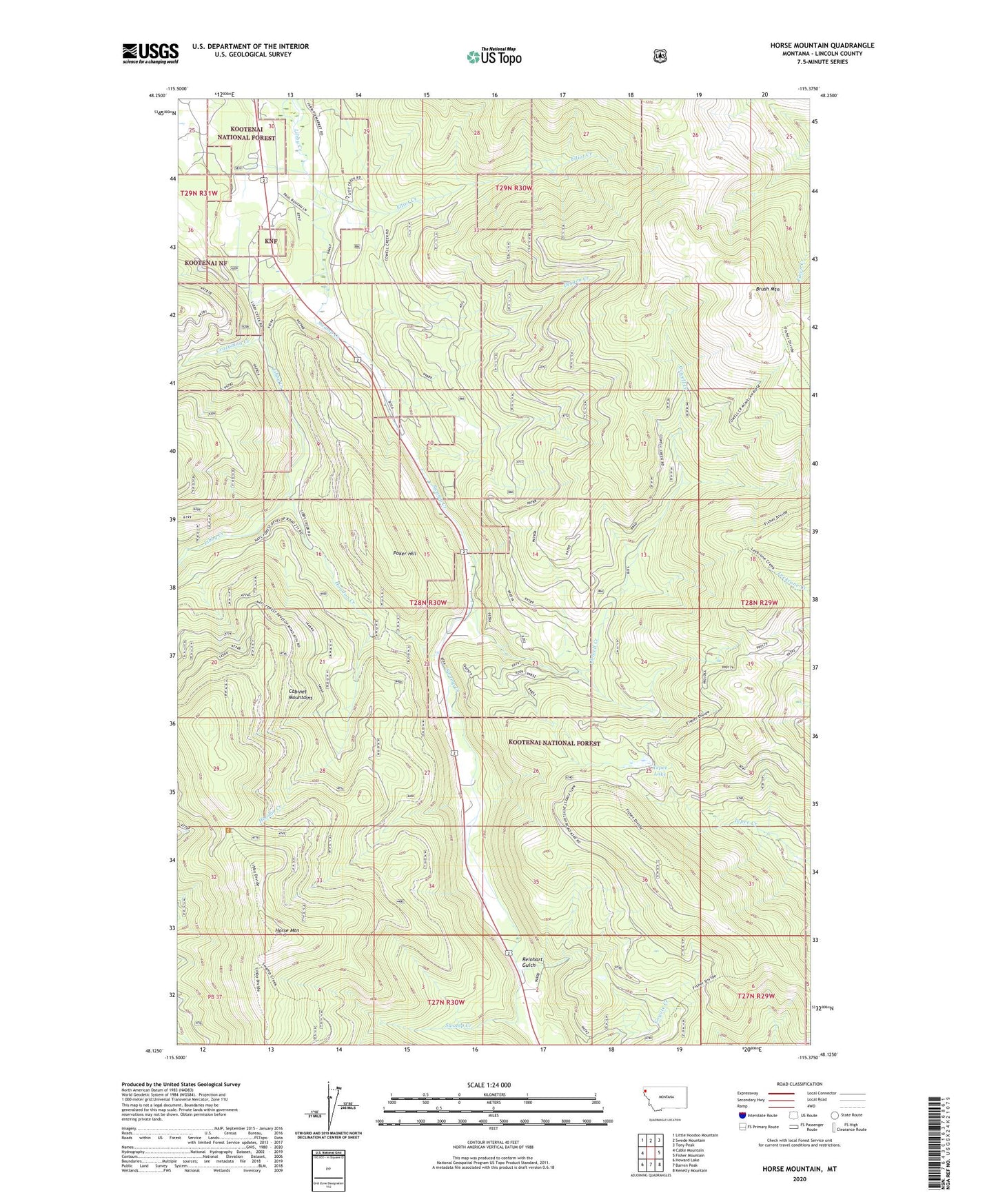
Horse Mountain Montana US Topo Map
Couldn't load pickup availability
Also explore the Horse Mountain Forest Service Topo of this same quad for updated USFS data
2024 topographic map quadrangle Horse Mountain in the state of Montana. Scale: 1:24000. Based on the newly updated USGS 7.5' US Topo map series, this map is in the following counties: Lincoln. The map contains contour data, water features, and other items you are used to seeing on USGS maps, but also has updated roads and other features. This is the next generation of topographic maps. Printed on high-quality waterproof paper with UV fade-resistant inks.
Quads adjacent to this one:
West: Cable Mountain
Northwest: Little Hoodoo Mountain
North: Swede Mountain
Northeast: Tony Peak
East: Fisher Mountain
Southeast: Kenelty Mountain
South: Barren Peak
Southwest: Howard Lake
This map covers the same area as the classic USGS quad with code o48115b4.
Contains the following named places: 29N30W31ACBA01 Well, 29N30W32BACC01 Well, 29N30W32BDBD01 Well, 59923, Brush Mountain, Cowell Creek, Coyote Creek Trail, Crazyman Creek, Detgen Creek, Elliot Creek, Hoodoo Creek, Horse Mountain, Horse Mountain Trail, Libby Creek Campground, Paul Bunyan Campground, Poker Hill, Reinhart Gulch, Swamp Creek, Tepee Lake