MyTopo
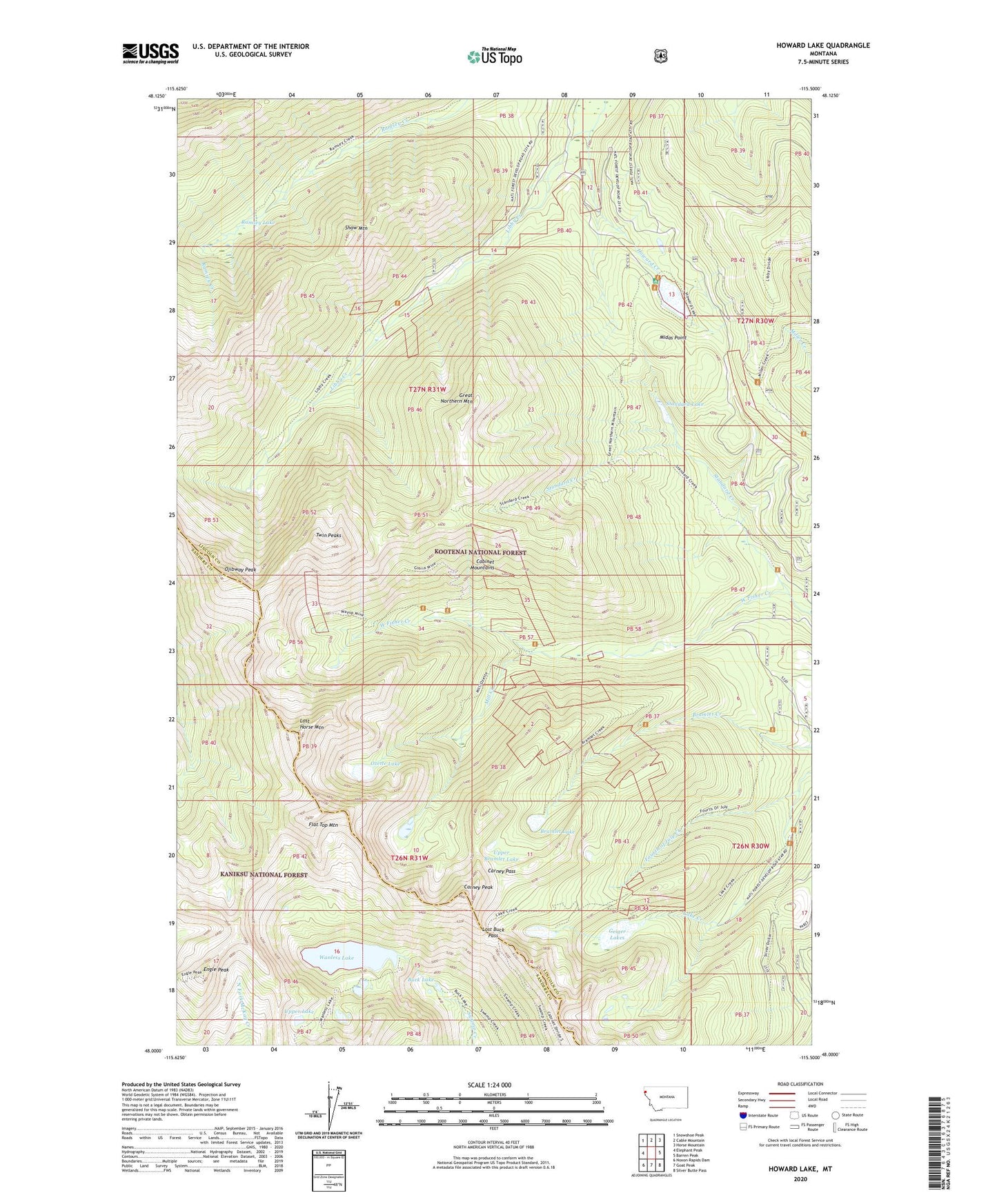
Howard Lake Montana US Topo Map
Couldn't load pickup availability
Also explore the Howard Lake Forest Service Topo of this same quad for updated USFS data
2024 topographic map quadrangle Howard Lake in the state of Montana. Scale: 1:24000. Based on the newly updated USGS 7.5' US Topo map series, this map is in the following counties: Lincoln, Sanders. The map contains contour data, water features, and other items you are used to seeing on USGS maps, but also has updated roads and other features. This is the next generation of topographic maps. Printed on high-quality waterproof paper with UV fade-resistant inks.
Quads adjacent to this one:
West: Elephant Peak
Northwest: Snowshoe Peak
North: Cable Mountain
Northeast: Horse Mountain
East: Barren Peak
Southeast: Silver Butte Pass
South: Goat Peak
Southwest: Noxon Rapids Dam
This map covers the same area as the classic USGS quad with code o48115a5.
Contains the following named places: American Kootenai Mine, Bramlet Creek Mine, Bramlet Lake, Branagan Mine, Buck Lake, Cabinet Post Office, Carney Pass, Carney Peak, Engle Peak, Flat Top Mountain, Fourth of July Creek, Geiger Lakes, Geiger Lakes Mine, George Shaw Spring, Gloria Mine, Golden West Mine, Great Northern Mine, Great Northern Mountain, Howard Creek, Howard Lake, Howard Lake Campground, Howard Lake Mine, Irish Boy Mine, Jumbo Mine, Lake Creek Trail, Libby Creek Mine, Lost Buck Pass, Lost Horse Mountain, Midas Mine, Midas Point, Mill Creek, Montezuma Mine, Ojibway Peak, Ozette Lake, Rainbow Mine, Ramsey Lake, Shaw Mountain, Standard Creek, Standard Creek Mine, Standard Lake, Twin Peaks, Upper Bramlet Lake, Upper Lake, Wanless Lake, Wayup Mine, West Fisher Creek Mine