MyTopo
Horseshoe Basin Montana US Topo Map
Couldn't load pickup availability
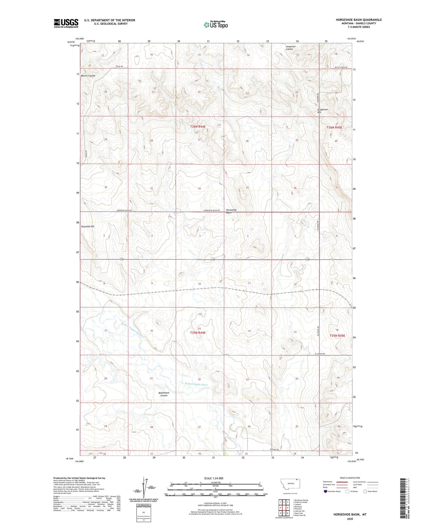
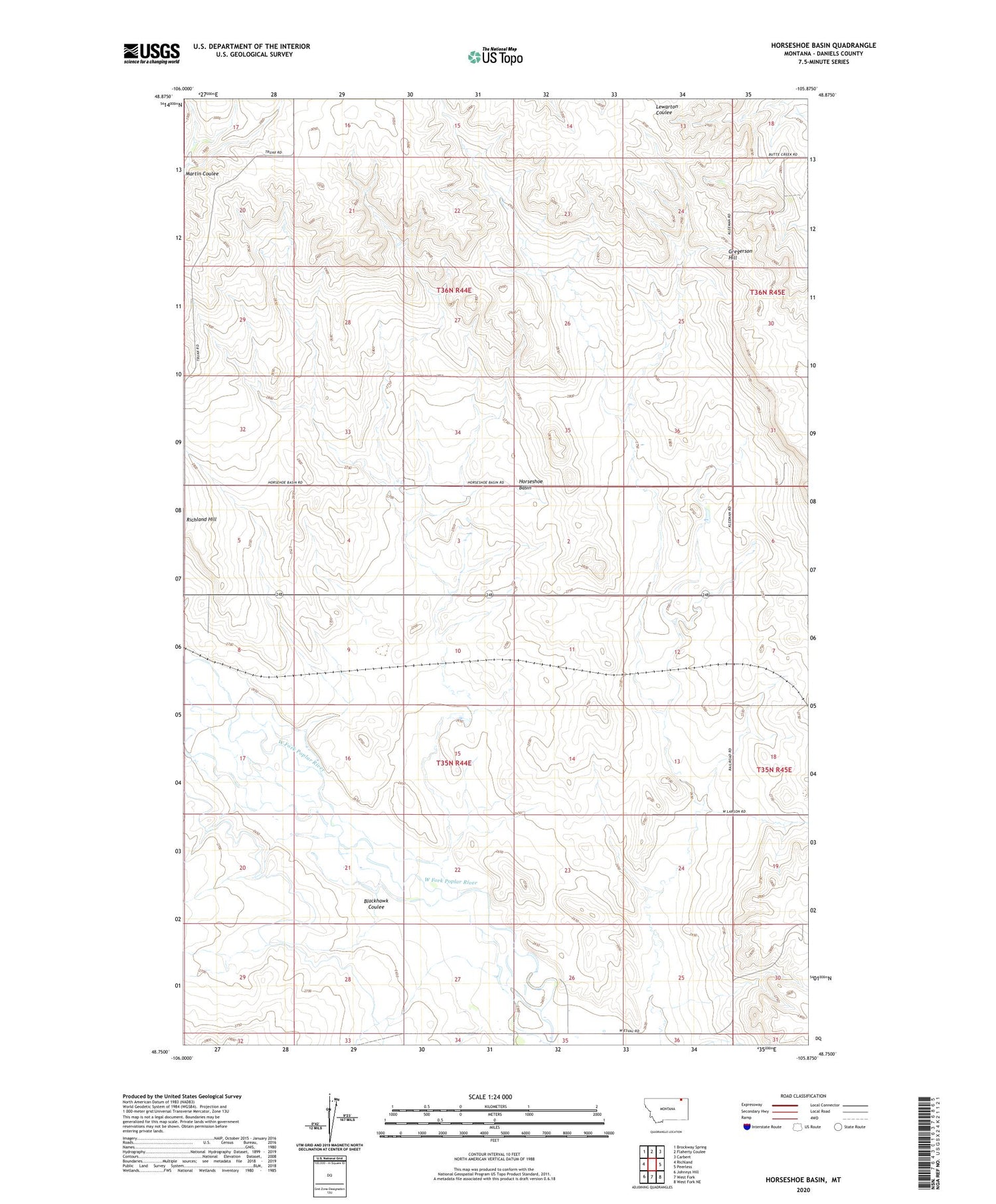
2020 topographic map quadrangle Horseshoe Basin in the state of Montana. Scale: 1:24000. Based on the newly updated USGS 7.5' US Topo map series, this map is in the following counties: Daniels. The map contains contour data, water features, and other items you are used to seeing on USGS maps, but also has updated roads and other features. This is the next generation of topographic maps. Printed on high-quality waterproof paper with UV fade-resistant inks.
Quads adjacent to this one:
West: Richland
Northwest: Brockway Spring
North: Flaherty Coulee
Northeast: Carbert
East: Peerless
Southeast: West Fork NE
South: West Fork
Southwest: Johnnys Hill
Contains the following named places: 35N44E04ADCC01 Well, 35N44E05CCDA01 Well, 35N44E08BCDA01 Well, 35N44E08BCDB01 Well, 35N44E08BCDC01 Well, 35N44E14AADB01 Well, 35N44E24BABC01 Well, 35N44E24BBAD01 Well, 35N44E24BBDA01 Well, 35N44E26BDCA01 Well, 35N44E26BDCA02 Well, 35N44E26BDCD01 Well, 35N44E26BDDB01 Well, 35N44E26BDDB02 Well, 35N44E26BDDC01 Well, 35N45E30ABBD01 Well, 35N45E30ABCA01 Well, 35N45E30BBBC01 Well, 36N44E17CCAA01 Well, 36N44E25DDDA01 Well, 36N44E25DDDA02 Well, 36N44E25DDDA03 Well, 36N44E25DDDD02 Well, Blackhawk Coulee, Gregerson Hill, Horseshoe Basin