MyTopo
Hysham Montana US Topo Map
Couldn't load pickup availability
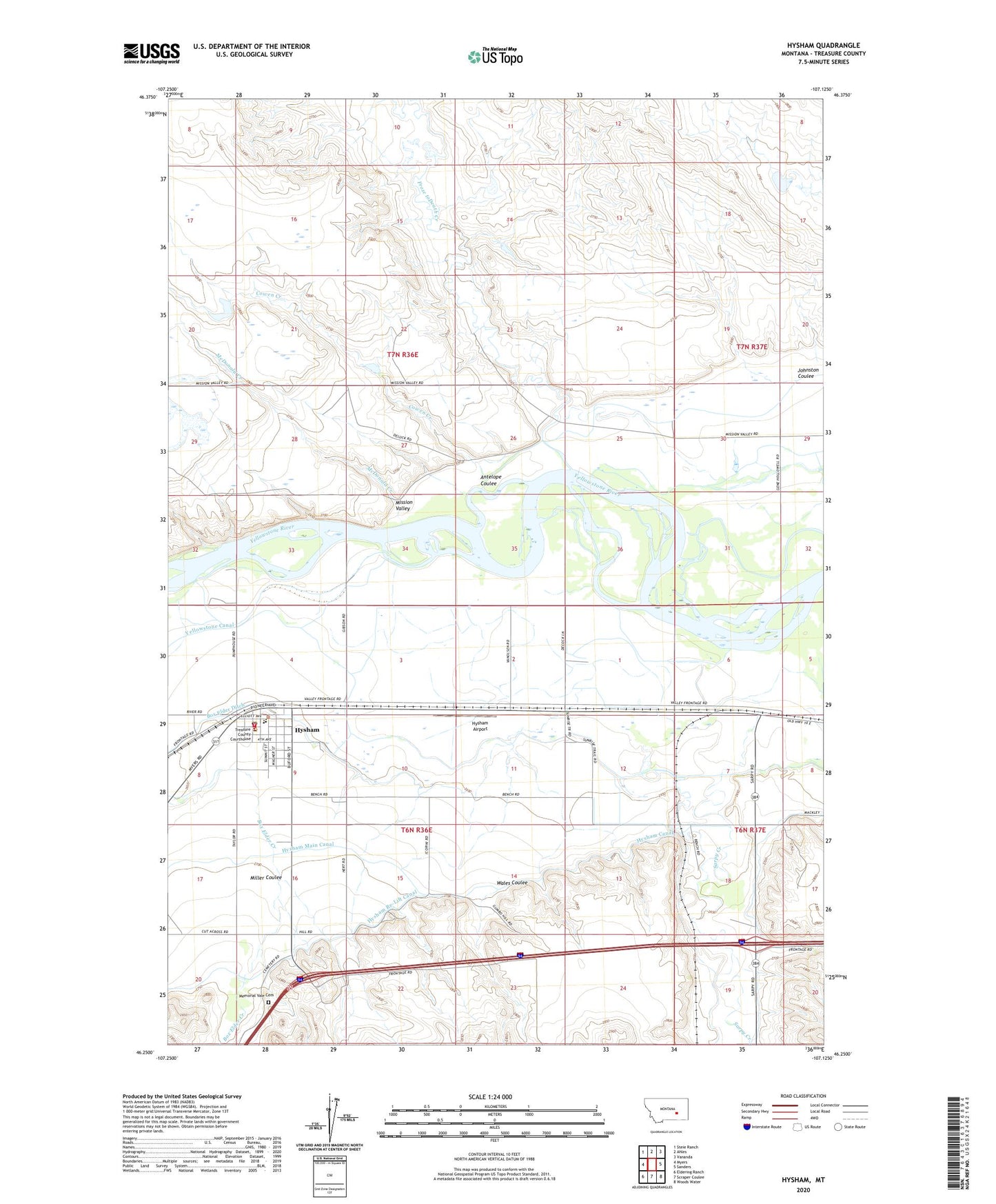
2024 topographic map quadrangle Hysham in the state of Montana. Scale: 1:24000. Based on the newly updated USGS 7.5' US Topo map series, this map is in the following counties: Treasure. The map contains contour data, water features, and other items you are used to seeing on USGS maps, but also has updated roads and other features. This is the next generation of topographic maps. Printed on high-quality waterproof paper with UV fade-resistant inks.
Quads adjacent to this one:
West: Myers
Northwest: Steie Ranch
North: Ahles
Northeast: Vananda
East: Sanders
Southeast: Woods Water
South: Scraper Coulee
Southwest: Eldering Ranch
This map covers the same area as the classic USGS quad with code o46107c2.
Contains the following named places: 06N36E01C___01 Well, 06N36E02A___01 Well, 06N36E09B___01 Well, 06N37E07C___01 Well, 07N36E15ABAA01 Well, Amelia Island Fishing Access Site, Antelope Coulee, Box Elder Creek, Box Elder Ditch, Community Presbyterian Church, Cowen Creek, Fort Sarpy, Froze to Death Creek, Froze to Death Number 7 Dam, Froze-to-Death, Froze-to-Death Land Company Number 1 Dam, Grierson Number 1 Dam, Hyde Post Office, Hysham, Hysham Airport, Hysham Baptist Church, Hysham Canal, Hysham Community Elevator, Hysham Community Health Clinic, Hysham Main Canal, Hysham Post Office, Hysham School, Hysham Volunteer Fire Department, Johnston Coulee, McDonald Creek, Memorial Vale Cemetery, Miller Coulee, Rutledge School, Saint Josephs Catholic Church, Sarpy Junction, Shoestring School, Stacy Island Fishing Access Site, Town of Hysham, Treasure County 89ers Museum, Treasure County Ambulance, Treasure County Courthouse, Treasure County Sheriff's Office, Trinity Lutheran Church, Wales Coulee, West Sanders School, Zent Hardware Company Elevator