MyTopo
Myers Montana US Topo Map
Couldn't load pickup availability
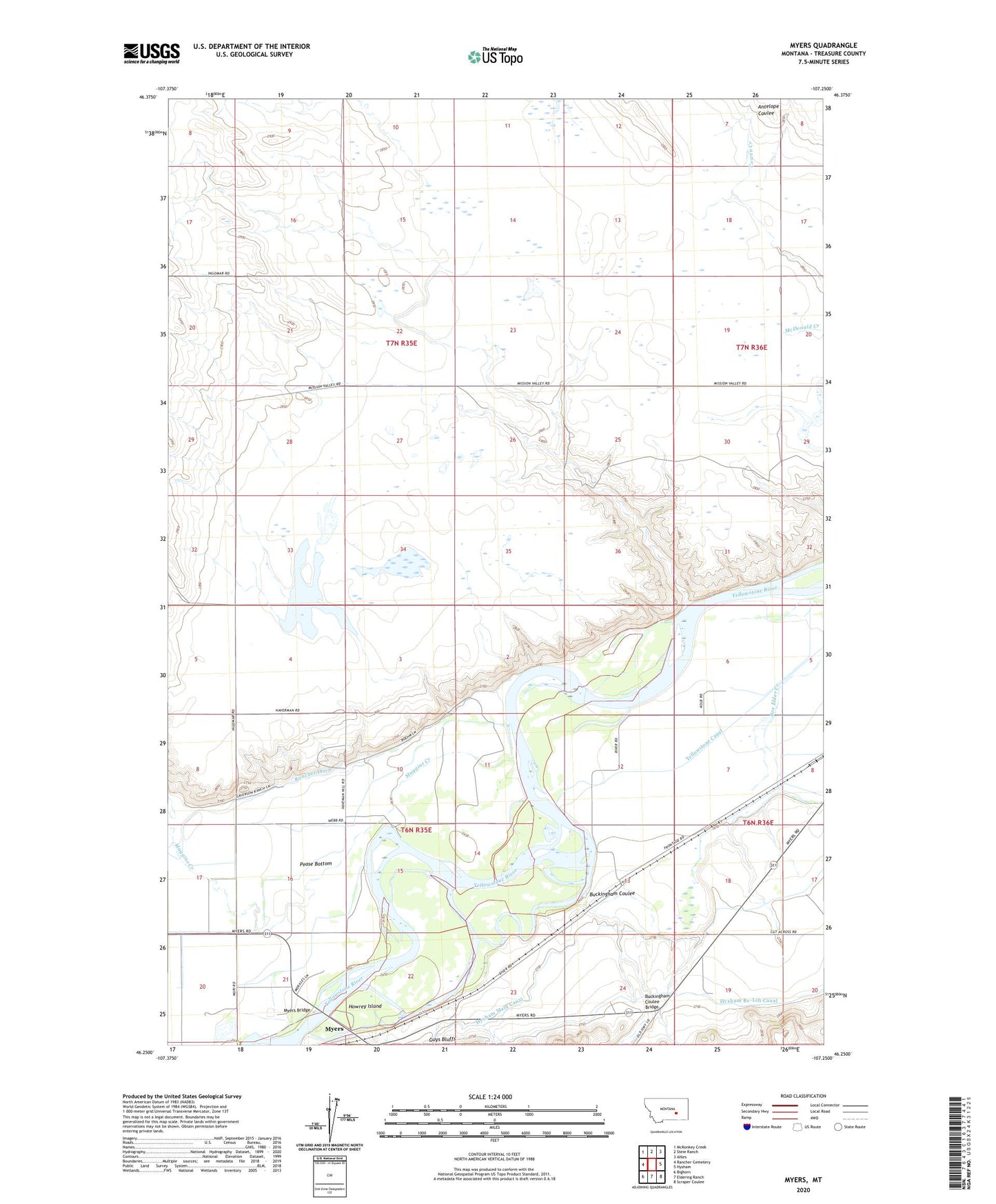
2024 topographic map quadrangle Myers in the state of Montana. Scale: 1:24000. Based on the newly updated USGS 7.5' US Topo map series, this map is in the following counties: Treasure. The map contains contour data, water features, and other items you are used to seeing on USGS maps, but also has updated roads and other features. This is the next generation of topographic maps. Printed on high-quality waterproof paper with UV fade-resistant inks.
Quads adjacent to this one:
West: Rancher Cemetery
Northwest: McKonkey Creek
North: Steie Ranch
Northeast: Ahles
East: Hysham
Southeast: Scraper Coulee
South: Eldering Ranch
Southwest: Bighorn
This map covers the same area as the classic USGS quad with code o46107c3.
Contains the following named places: 06N35E03C___01 Well, 06N35E05DAC_01 Well, 06N36E07AD__01 Well, Buckingham Coulee, Buckingham Coulee Bridge, Cozy Nook School, Decock Number 3 Dam, Howrey Island, Hysham Re-Lift Canal, Lake View School, Muggins Creek, Myers, Myers Bridge, Myers Bridge Fishing Access Site, Myers Post Office, Myers Siding, Rancher Church, Rancher School, Riverside School