MyTopo
Eldering Ranch Montana US Topo Map
Couldn't load pickup availability
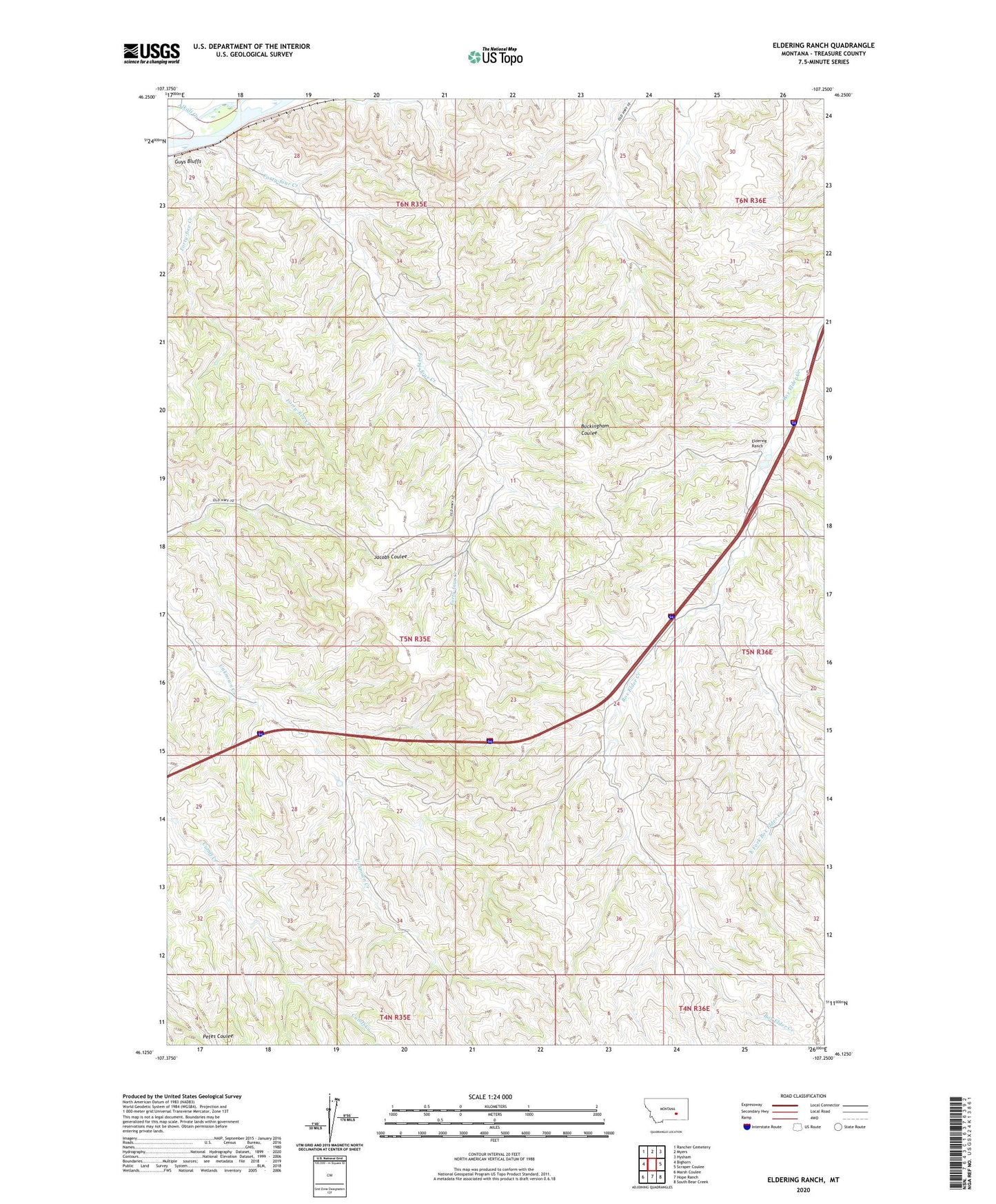
2024 topographic map quadrangle Eldering Ranch in the state of Montana. Scale: 1:24000. Based on the newly updated USGS 7.5' US Topo map series, this map is in the following counties: Treasure. The map contains contour data, water features, and other items you are used to seeing on USGS maps, but also has updated roads and other features. This is the next generation of topographic maps. Printed on high-quality waterproof paper with UV fade-resistant inks.
Quads adjacent to this one:
West: Bighorn
Northwest: Rancher Cemetery
North: Myers
Northeast: Hysham
East: Scraper Coulee
Southeast: South Bear Creek
South: Hope Ranch
Southwest: Marsh Coulee
This map covers the same area as the classic USGS quad with code o46107b3.
Contains the following named places: 05N35E04A___01 Well, 05N35E15AADA01 Well, 05N36E07ABDC01 Well, Alkali Creek, Almond School, East Fork Box Elder Creek, Eldering Ranch, Forty-five Creek, Forty-four Creek, Treasure County