MyTopo
Intake NW Montana US Topo Map
Couldn't load pickup availability
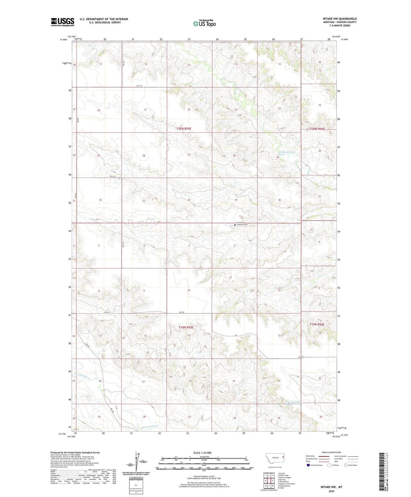
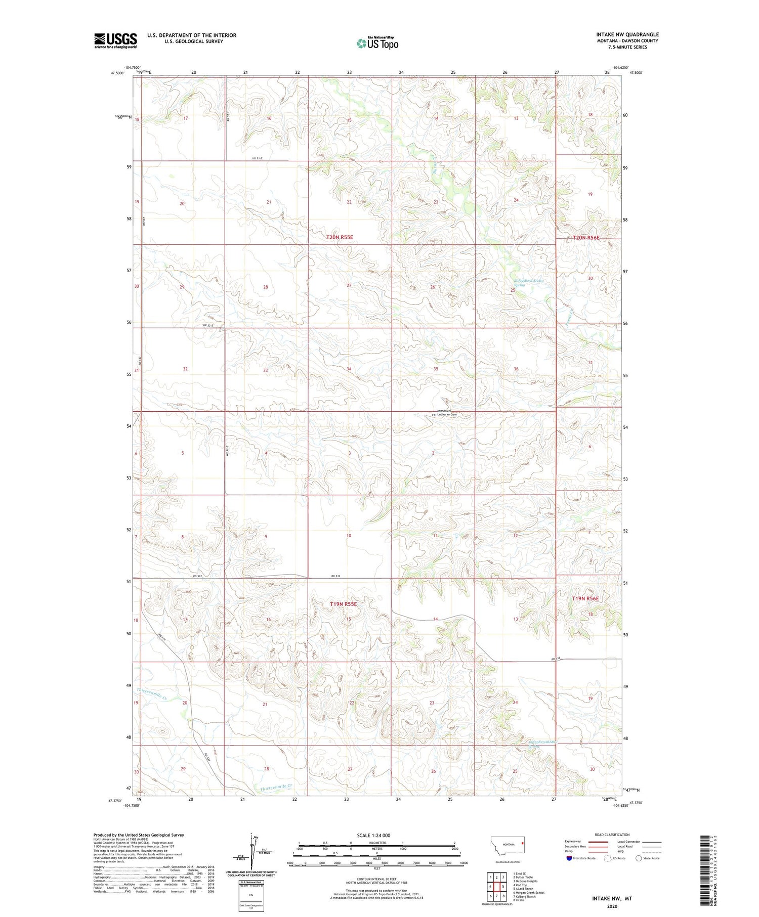
2020 topographic map quadrangle Intake NW in the state of Montana. Scale: 1:24000. Based on the newly updated USGS 7.5' US Topo map series, this map is in the following counties: Dawson. The map contains contour data, water features, and other items you are used to seeing on USGS maps, but also has updated roads and other features. This is the next generation of topographic maps. Printed on high-quality waterproof paper with UV fade-resistant inks.
Quads adjacent to this one:
West: Red Top
Northwest: Enid SE
North: Butler Table
Northeast: McCone Heights
East: Allard Ranch
Southeast: Intake
South: Kolberg Ranch
Southwest: Morgan Creek School
Contains the following named places: 19N55E08DDDA01 Well, 19N55E12BDDD01 Well, 19N55E14BCDD01 Well, 19N55E22CACD01 Well, 19N55E25ABAB01 Spring, 19N56E06ABCD01 Well, 20N55E12BC__01 Well, 20N55E15BACB01 Well, 20N55E20CBCA01 Well, 20N55E22BBCC01 Well, 20N55E25CAAA01 Spring, 20N55E32AAAA01 Well, 20N55E32AAAA02 Well, East Pleasant Plains School, Immanuel Lutheran Cemetery, Pleasant Plains School