MyTopo
Intake Montana US Topo Map
Couldn't load pickup availability
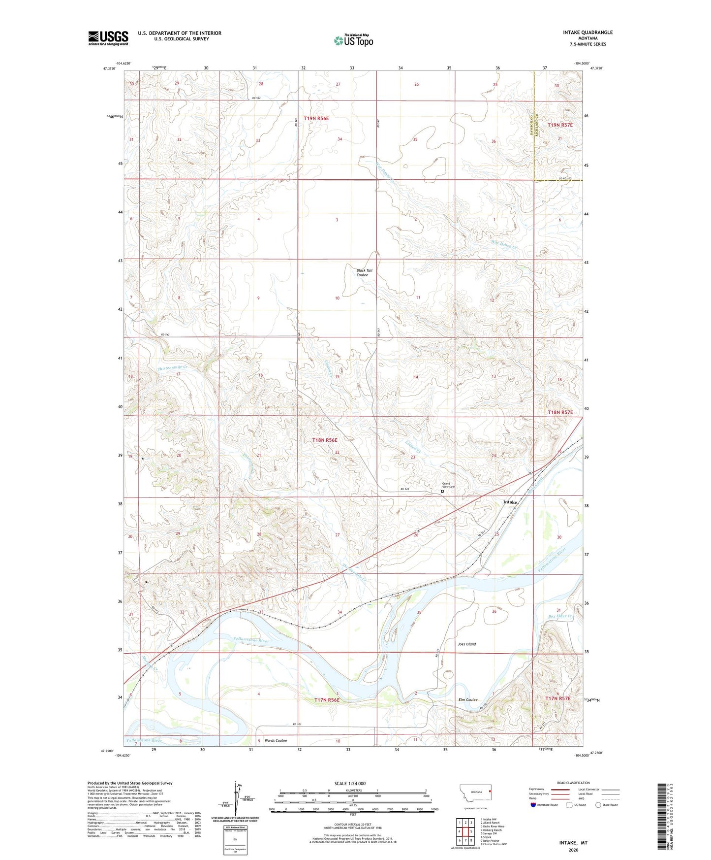
2024 topographic map quadrangle Intake in the state of Montana. Scale: 1:24000. Based on the newly updated USGS 7.5' US Topo map series, this map is in the following counties: Dawson, Richland. The map contains contour data, water features, and other items you are used to seeing on USGS maps, but also has updated roads and other features. This is the next generation of topographic maps. Printed on high-quality waterproof paper with UV fade-resistant inks.
Quads adjacent to this one:
West: Kolberg Ranch
Northwest: Intake NW
North: Allard Ranch
Northeast: Knife River Mine
East: Savage SW
Southeast: Cluster Buttes NW
South: Belle Prairie
Southwest: Stipek
This map covers the same area as the classic USGS quad with code o47104c5.
Contains the following named places: 17N56E04BDC_01 Well, 17N56E04DC__01 Well, 17N56E04DC__02 Well, 17N56E04DC__03 Well, 17N56E11BBBB01 Well, 18N56E15BDBD01 Well, 18N56E24DCDD01 Well, 18N56E24DCDD02 Well, 18N56E25ADBA01 Well, 18N56E25ADBA02 Well, 18N56E25CB__01 Well, 18N56E25DB__01 Well, 18N56E26DD__01 Well, 18N56E26DD__02 Well, 18N56E29ADBA01 Well, 18N56E34AB__01 Well, 18N56E34ABDB01 Well, 18N56E36BB__01 Well, 18N57E18CBDB01 Well, 18N57E19CA__01 Well, 19N56E26CBCA01 Well, Box Elder Creek, Corom Creek, Elm Coulee, First Congregational Church of Intake, Grand View Cemetery, Intake, Intake Dam Fishing Access Site, Intake Post Office, Intake School, Joes Island, Ladwig School, Linden Creek, Lower Yellowstone Diversion Dam, Morgan Creek, Thirteenmile Creek