MyTopo
Allard Ranch Montana US Topo Map
Couldn't load pickup availability
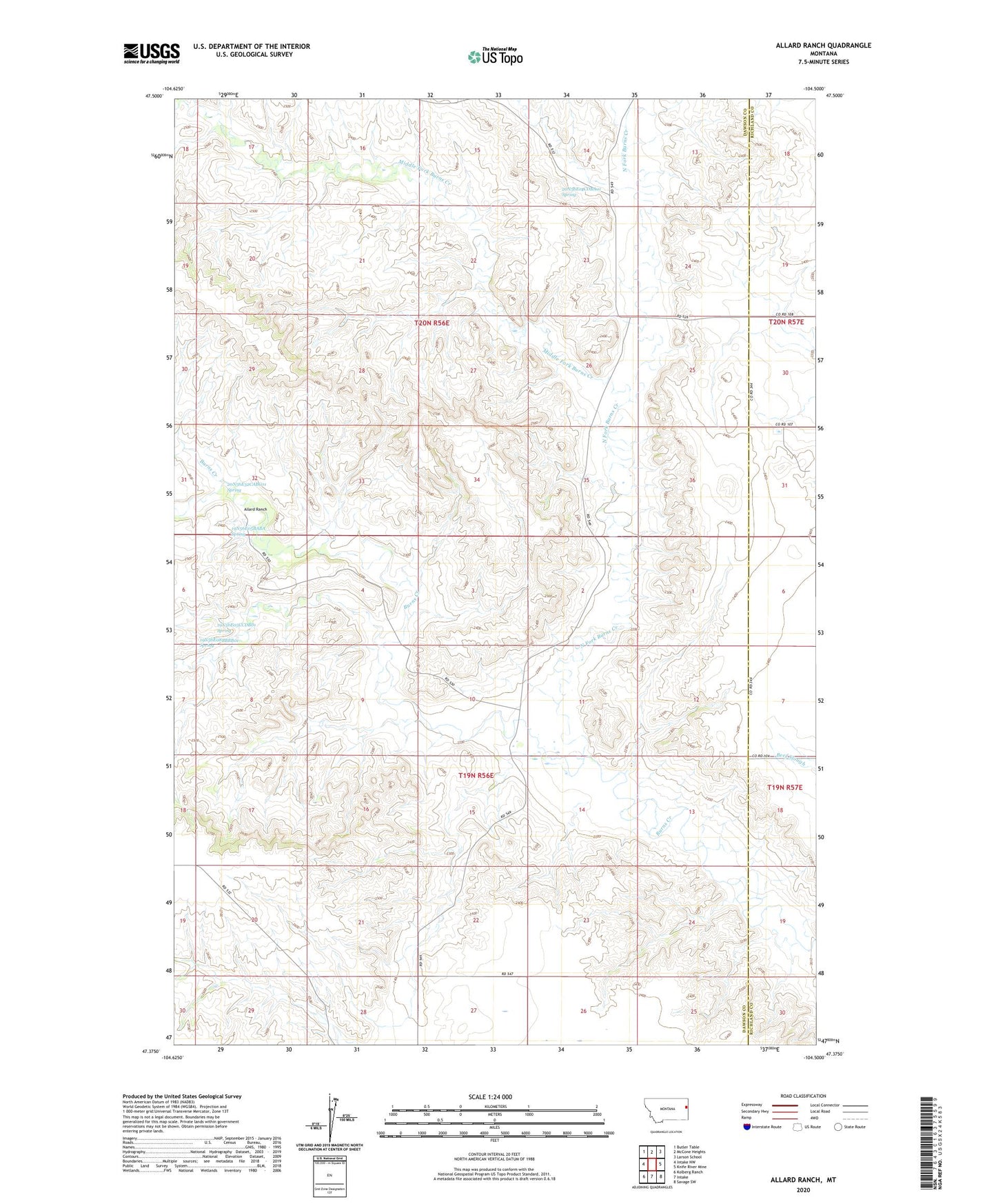
2024 topographic map quadrangle Allard Ranch in the state of Montana. Scale: 1:24000. Based on the newly updated USGS 7.5' US Topo map series, this map is in the following counties: Dawson, Richland. The map contains contour data, water features, and other items you are used to seeing on USGS maps, but also has updated roads and other features. This is the next generation of topographic maps. Printed on high-quality waterproof paper with UV fade-resistant inks.
Quads adjacent to this one:
West: Intake NW
Northwest: Butler Table
North: McCone Heights
Northeast: Larson School
East: Knife River Mine
Southeast: Savage SW
South: Intake
Southwest: Kolberg Ranch
This map covers the same area as the classic USGS quad with code o47104d5.
Contains the following named places: 19N55E04DDAD01 Well, 19N56E05BABA__ Spring, 19N56E05CCDB01 Spring, 19N56E08BBBB01 Spring, 20N56E13CBAA01 Well, 20N56E14CDBA01 Spring, 20N56E18AAAD01 Well, 20N56E18ADBB01 Well, 20N56E24CBDB01 Well, 20N56E25BABB01 Well, 20N56E26DCCB01 Well, 20N56E32CABC01 Spring, 20N56E32CDAA01 Well, Allard Ranch, Burns Creek School, Harley Post Office, Middle Fork Burns Creek, North Fork Burns Creek, Reeta Post Office