MyTopo
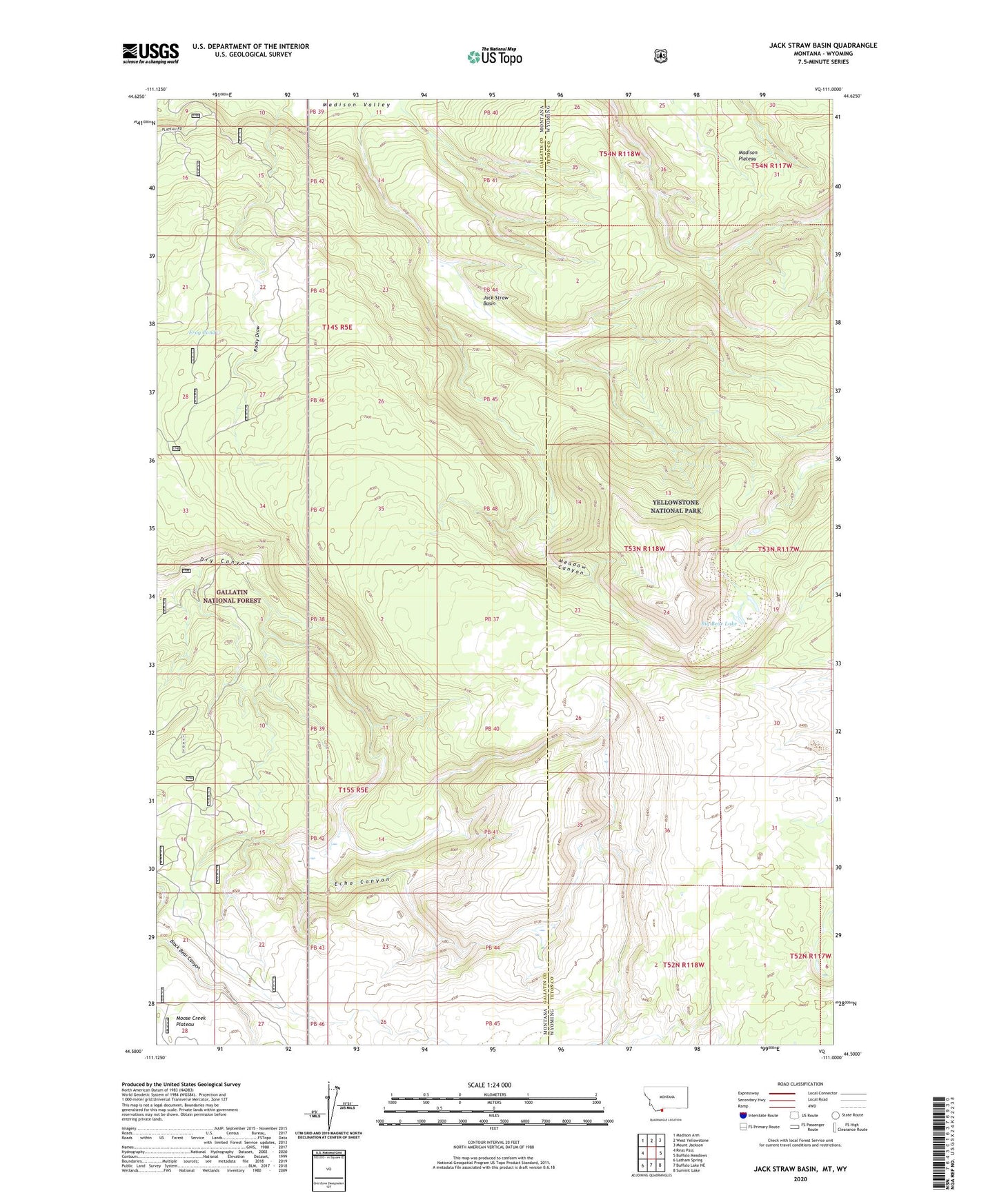
Jack Straw Basin Montana US Topo Map
Couldn't load pickup availability
Also explore the Jack Straw Basin Forest Service Topo of this same quad for updated USFS data
2024 topographic map quadrangle Jack Straw Basin in the states of Montana, Wyoming. Scale: 1:24000. Based on the newly updated USGS 7.5' US Topo map series, this map is in the following counties: Gallatin, Teton. The map contains contour data, water features, and other items you are used to seeing on USGS maps, but also has updated roads and other features. This is the next generation of topographic maps. Printed on high-quality waterproof paper with UV fade-resistant inks.
Quads adjacent to this one:
West: Reas Pass
Northwest: Madison Arm
North: West Yellowstone
Northeast: Mount Jackson
East: Buffalo Meadows
Southeast: Summit Lake
South: Buffalo Lake NE
Southwest: Latham Spring
Contains the following named places: Big Bear Lake, Echo Canyon, Frog Pond, Jack Straw Basin, Madison Plateau, Meadow Canyon, Rocky Draw, South Riverside Cabin