
MyTopo
Johnnie Creek Montana US Topo Map
Couldn't load pickup availability
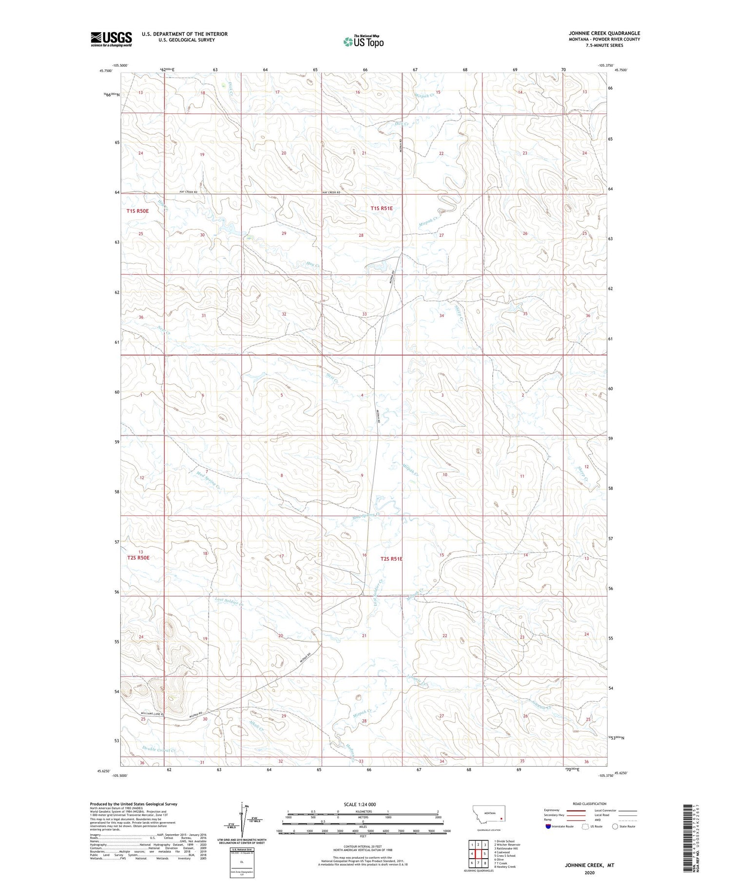
2020 topographic map quadrangle Johnnie Creek in the state of Montana. Scale: 1:24000. Based on the newly updated USGS 7.5' US Topo map series, this map is in the following counties: Powder River. The map contains contour data, water features, and other items you are used to seeing on USGS maps, but also has updated roads and other features. This is the next generation of topographic maps. Printed on high-quality waterproof paper with UV fade-resistant inks.
Quads adjacent to this one:
West: Coalwood
Northwest: Divide School
North: Witcher Reservoir
Northeast: Rattlesnake Hill
East: Cross S School
Southeast: Hawkey Creek
South: T Creek
Southwest: Olive
Contains the following named places: 01S51E15DBDA01 Well, 01S51E20DAAA01 Well, 01S51E22CBBD01 Well, 01S51E23CACC01 Well, 01S51E27ACAA01 Well, 01S51E27BBCC01 Well, 01S51E34ABCC01 Well, 02S51E18ABCC01 Well, 02S51E21ACBB01 Well, 02S51E29DABA01 Well, 59343, A Irion Number 1 Dam, Alkali Creek, Dick Creek, Hay Creek, Hudson Creek, J Janssen Number 1 Dam, Johnnie Creek, Lost Soldier Creek, Mud Spring Creek, Nest Creek, Russiff Number 1 Dam, Sheep Creek


