MyTopo
Mount Carter Montana US Topo Map
Couldn't load pickup availability
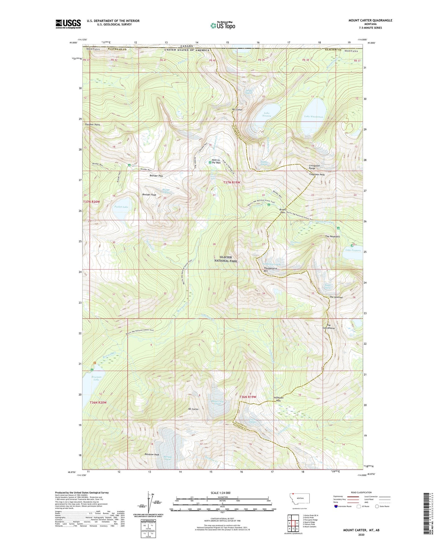
2024 topographic map quadrangle Mount Carter in the state of Montana. Scale: 1:24000. Based on the newly updated USGS 7.5' US Topo map series, this map is in the following counties: Flathead, Glacier. The map contains contour data, water features, and other items you are used to seeing on USGS maps, but also has updated roads and other features. This is the next generation of topographic maps. Printed on high-quality waterproof paper with UV fade-resistant inks.
Quads adjacent to this one:
West: Kintla Peak
Northwest: Kintla Peak OE N
East: Porcupine Ridge
Southeast: Mount Geduhn
South: Vulture Peak
Southwest: Quartz Ridge
This map covers the same area as the classic USGS quad with code o48114h1.
Contains the following named places: Boulder Glacier, Boulder Pass, Boulder Peak, Brown Pass, Cameron Lake, Carter Glaciers, Chapman Peak, Dixon Glacier, Herbst Glacier, Hole-in-the Wall, Hole-in-the Wall Falls, Hudson Glacier, Jefferson Creek, Jefferson Pass, Lake Frances, Lake Nooney, Lake Wurdeman, Livingston Range, Mount Carter, Mount Custer, North Lakes, Numa Creek, Pocket Creek, Pocket Lake, Rainbow Glacier, Rainbow Peak, The Guardhouse, The Hawksbill, The Sentinel, Thunderbird Creek, Thunderbird Falls, Thunderbird Glacier, Thunderbird Mountain, Weasel Collar Glacier