MyTopo
Quinns Hot Springs Montana US Topo Map
Couldn't load pickup availability
Also explore the Quinns Hot Springs Forest Service Topo of this same quad for updated USFS data
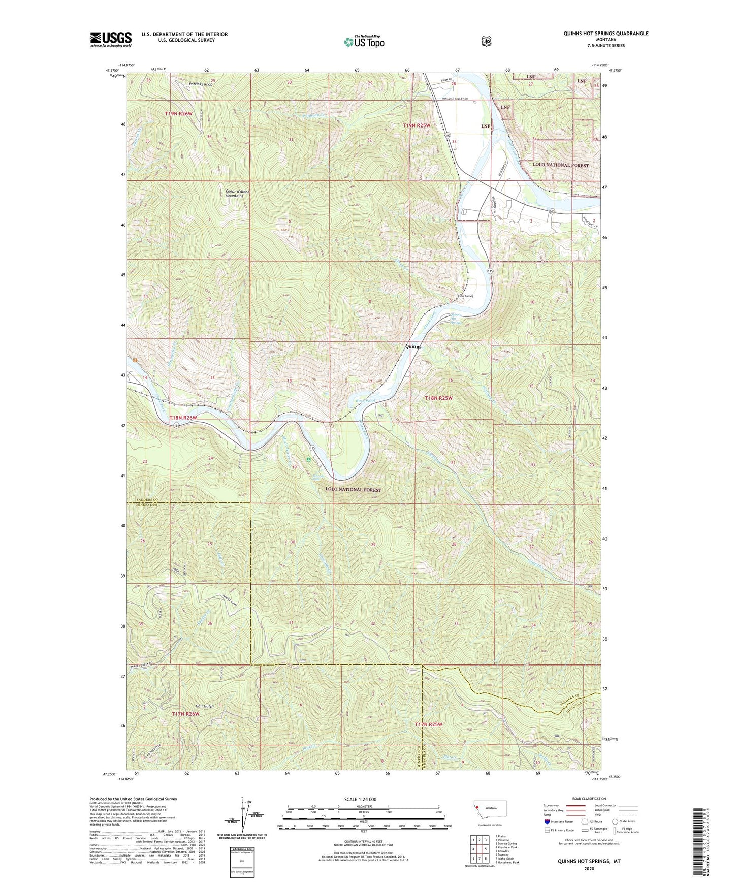
2024 topographic map quadrangle Quinns Hot Springs in the state of Montana. Scale: 1:24000. Based on the newly updated USGS 7.5' US Topo map series, this map is in the following counties: Sanders, Mineral, Missoula. The map contains contour data, water features, and other items you are used to seeing on USGS maps, but also has updated roads and other features. This is the next generation of topographic maps. Printed on high-quality waterproof paper with UV fade-resistant inks.
Quads adjacent to this one:
West: Keystone Peak
Northwest: Plains
North: Paradise
Northeast: Sunrise Spring
East: Knowles
Southeast: Horsehead Peak
South: Idaho Gulch
Southwest: Superior
This map covers the same area as the classic USGS quad with code o47114c7.
Contains the following named places: Bass Pond, Belle of the Hills Mine, Cascade Creek, Cascade Creek Campground, Cascade Falls, Dillon Millsite, Dragonfly Creek, Falls Creek, Flathead River, Fourteenmile Creek, Hall Gulch Mine, Hopkins, Hopkins Mine, Island City, John Tunnel, Kennedy Creek, Much Water Creek, Pardee Camp, Patricks Knob, Quinns, Quinns Hot Springs, Quinns Hot Springs Resort, Sheep Creek, Siegel Creek, Victor Mine, Wallace Creek, West Hall Gulch Mine