MyTopo
Horsehead Peak Montana US Topo Map
Couldn't load pickup availability
Also explore the Horsehead Peak Forest Service Topo of this same quad for updated USFS data
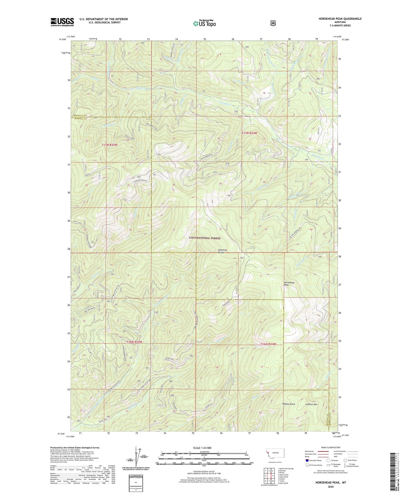
2024 topographic map quadrangle Horsehead Peak in the state of Montana. Scale: 1:24000. Based on the newly updated USGS 7.5' US Topo map series, this map is in the following counties: Missoula, Mineral. The map contains contour data, water features, and other items you are used to seeing on USGS maps, but also has updated roads and other features. This is the next generation of topographic maps. Printed on high-quality waterproof paper with UV fade-resistant inks.
Quads adjacent to this one:
West: Idaho Gulch
Northwest: Quinns Hot Springs
North: Knowles
Northeast: Perma
East: Stark North
Southeast: Stark South
South: Tarkio
Southwest: Lozeau
This map covers the same area as the classic USGS quad with code o47114b6.
Contains the following named places: Antelope Creek, Beecher Creek, Burnt Fork Creek, D J Silver/Saint Louis Mine, Devils Creek, East Fork Beecher Creek, East Fork Burnt Fork Creek, Eustache Creek, Frances Copper Mine, Granite Number 2 Mine, Horsehead Peak, Liquidator Mine, Liquidator Number 2 Mine, Lookout Fraction Number 3 Mine, Lookout Mountain, Lower Eddy Creek Mine, Lower Ninemile Mine, Lucy Ellen Mine, Martina, Martina Creek, Martina Creek Mine, Martina Mine, Martina Post Office, Mattie V Creek, Montreal, Ninemile Creek Mine, Ninemile Mine, North Fork Second Creek, Nugget Creek, Old Town, Oliver Creek, Pats Creek, Queue Creek, Saint Louis Creek, Sawpit Creek, Sparks Creek, Upper Eddy Creek Mine, Upper Ninemile Mine, War Eagle Mine, West Fork Beecher Creek, West Fork Burnt Fork Creek