MyTopo
Knowles Peak Montana US Topo Map
Couldn't load pickup availability
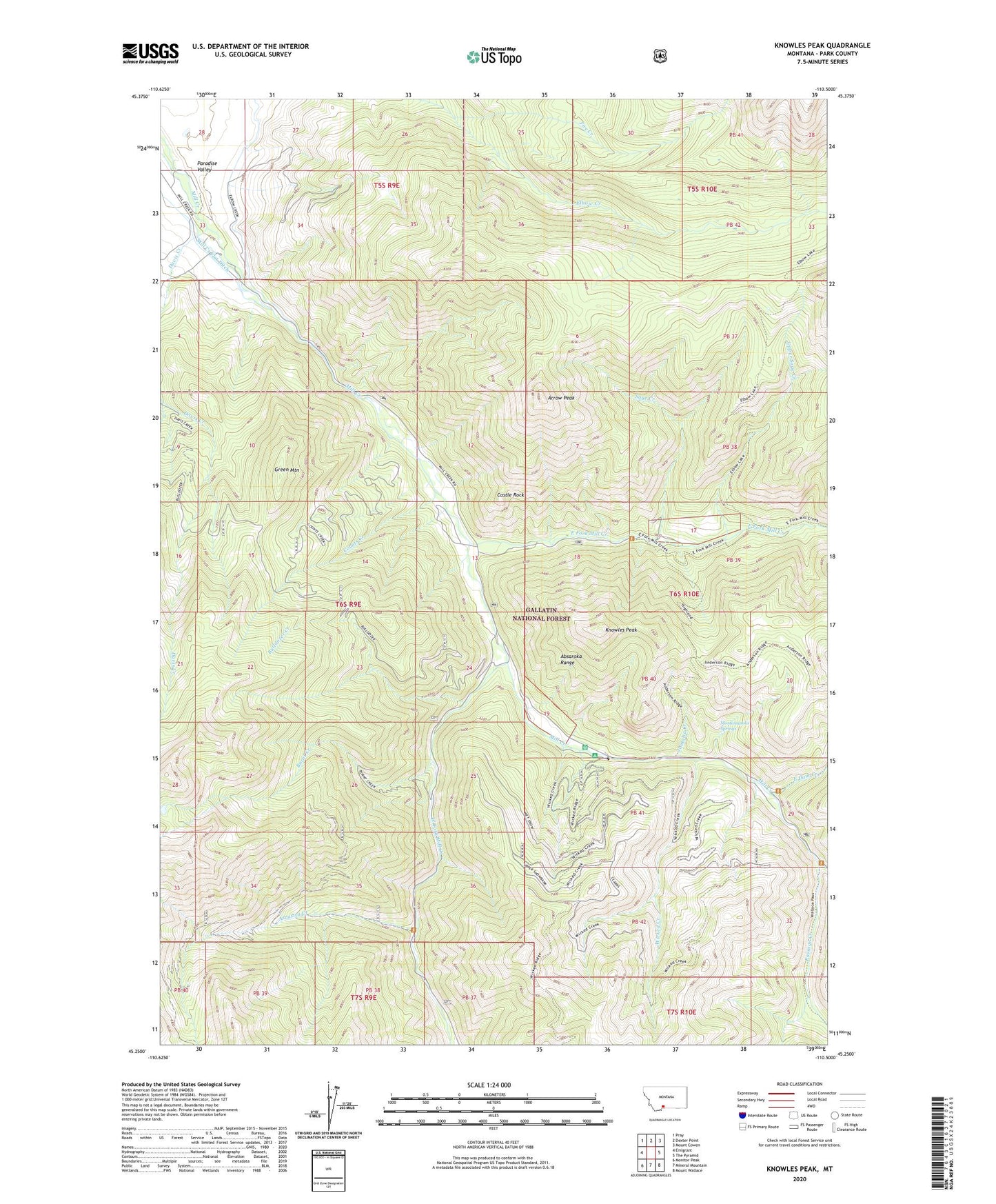
2020 topographic map quadrangle Knowles Peak in the state of Montana. Scale: 1:24000. Based on the newly updated USGS 7.5' US Topo map series, this map is in the following counties: Park. The map contains contour data, water features, and other items you are used to seeing on USGS maps, but also has updated roads and other features. This is the next generation of topographic maps. Printed on high-quality waterproof paper with UV fade-resistant inks.
Quads adjacent to this one:
West: Emigrant
Northwest: Pray
North: Dexter Point
Northeast: Mount Cowen
East: The Pyramid
Southeast: Mount Wallace
South: Mineral Mountain
Southwest: Monitor Peak
Contains the following named places: Alice C Mine, Arrastra Creek, Arrow Peak, Barbara Ann Mine, Bow and Arrow Ranch, Bulldozer Creek, Burnt Creek, Castle Rock, Counts Creek, Davis Creek, East Dam Creek, East Fork Mill Creek, Fire Creek, Green Mountain, Highland Trail, Jomaha Creek, Knowles Peak, Merlyn Mine, Mill Creek Camp and Picnic Grounds, Mill Creek Guard Station, Mill Creek Ranch, Montanapolis School, Montanapolis Springs, NE Section 4 - FS Mine, Passage Creek, Queen Esther Mine, Sage Creek, SE Section 23 Mine, Snowbank Campground, Snowy Range Ranch, Templed Hills, Upper Sage Creek, West Fork Mill Creek, Wicked Creek, Yellowstone Bible Encampment