MyTopo
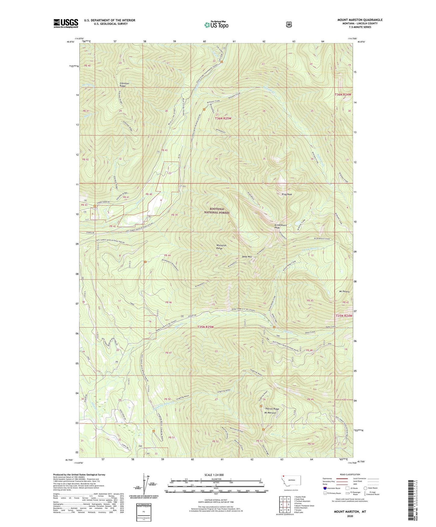
Mount Marston Montana US Topo Map
Couldn't load pickup availability
Also explore the Mount Marston Forest Service Topo of this same quad for updated USFS data
2024 topographic map quadrangle Mount Marston in the state of Montana. Scale: 1:24000. Based on the newly updated USGS 7.5' US Topo map series, this map is in the following counties: Lincoln. The map contains contour data, water features, and other items you are used to seeing on USGS maps, but also has updated roads and other features. This is the next generation of topographic maps. Printed on high-quality waterproof paper with UV fade-resistant inks.
Quads adjacent to this one:
West: Fortine
Northwest: Ksanka Peak
North: Stahl Peak
Northeast: Tuchuck Mountain
East: Mount Thompson-Seton
Southeast: Bull Lake
South: Stryker
Southwest: Edna Mountain
This map covers the same area as the classic USGS quad with code o48114g7.
Contains the following named places: 35N25W32ADCB01 Well, 36N25W05CCBA01 Well, 59918, Cat Creek, Deep Mountain, Jager Mine, Krag Peak, Krinklehorn Peak, Mount Marston, Mount Marston Lookout, Mount Marston National Recreation Trail, North Fork Deep Creek, Patrick Ridge, Vredenburg Dam, Williams Creek