MyTopo
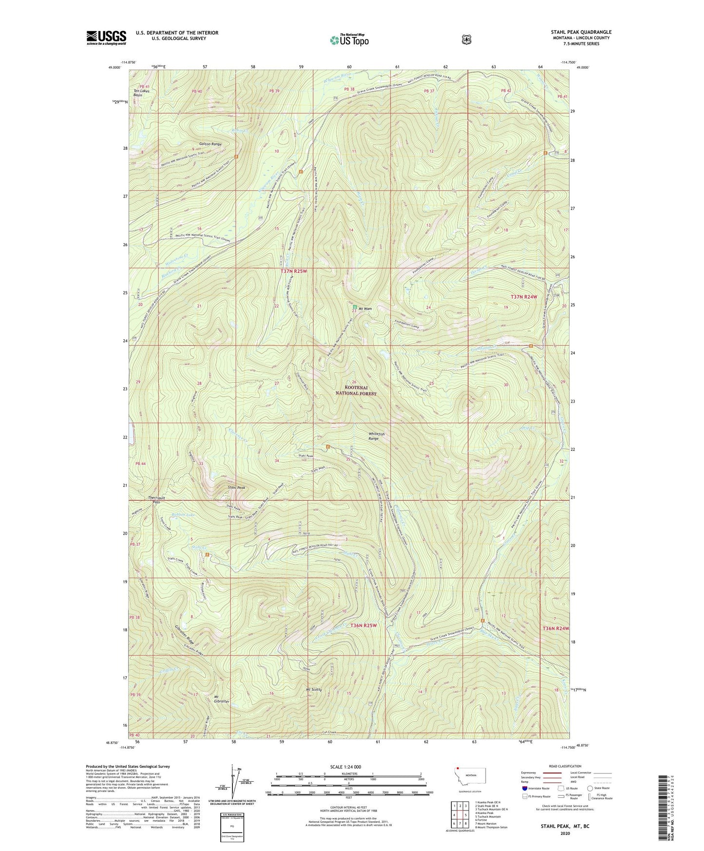
Stahl Peak Montana US Topo Map
Couldn't load pickup availability
Also explore the Stahl Peak Forest Service Topo of this same quad for updated USFS data
2024 topographic map quadrangle Stahl Peak in the state of Montana. Scale: 1:24000. Based on the newly updated USGS 7.5' US Topo map series, this map is in the following counties: Lincoln. The map contains contour data, water features, and other items you are used to seeing on USGS maps, but also has updated roads and other features. This is the next generation of topographic maps. Printed on high-quality waterproof paper with UV fade-resistant inks.
Quads adjacent to this one:
West: Ksanka Peak
Northwest: Ksanka Peak OE N
North: Stahl Peak OE N
Northeast: Tuchuck Mountain OE N
East: Tuchuck Mountain
Southeast: Mount Thompson-Seton
South: Mount Marston
Southwest: Fortine
This map covers the same area as the classic USGS quad with code o48114h7.
Contains the following named places: Baboon Lake, Blue Sky Creek, Bluebird Creek, Clarence Creek, Drip Creek, Foundation Creek, Gibralter Ridge, Grave Creek Snow Gage, Jiggs Creek, Kopsi Creek, Lewis Creek, Mount Gibralter, Mount Scotty, Mount Wam, Rich Creek, Robin Creek, South Fork Clarence Creek, Stahl Creek, Stahl Peak, Stahl Peak Snow Gage, Therriault Pass, Wam Creek, Weasel Divide Snow Gage, Wolverine Creek