MyTopo
Lake Mason Montana US Topo Map
Couldn't load pickup availability
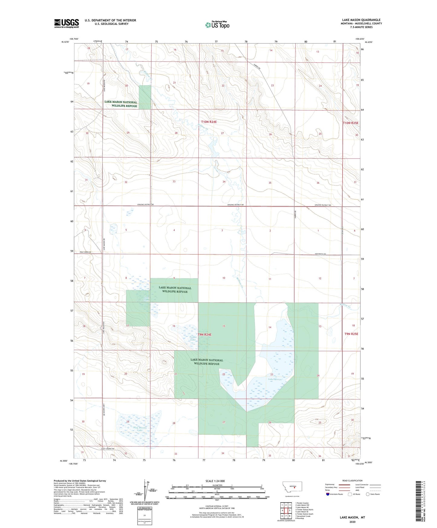
2024 topographic map quadrangle Lake Mason in the state of Montana. Scale: 1:24000. Based on the newly updated USGS 7.5' US Topo map series, this map is in the following counties: Musselshell. The map contains contour data, water features, and other items you are used to seeing on USGS maps, but also has updated roads and other features. This is the next generation of topographic maps. Printed on high-quality waterproof paper with UV fade-resistant inks.
Quads adjacent to this one:
West: Timber Buttes North
Northwest: Pender Coulee
North: Lake Mason NW
Northeast: Lake Mason NE
East: Lake Mason SE
Southeast: Roundup
South: Horsethief Creek
Southwest: Timber Buttes South
This map covers the same area as the classic USGS quad with code o46108e6.
Contains the following named places: 09N24E08BBBD01 Well, 09N25E06CCCA01 Well, 10N24E29D___01 Well, 10N24E32D___01 Well, Ernie Number 1 Dam, Lake Mason, Lake Mason National Wildlife Refuge Dam, Lake Thom, May Martin Lake, Talbot Lake