MyTopo
Horsethief Creek Montana US Topo Map
Couldn't load pickup availability
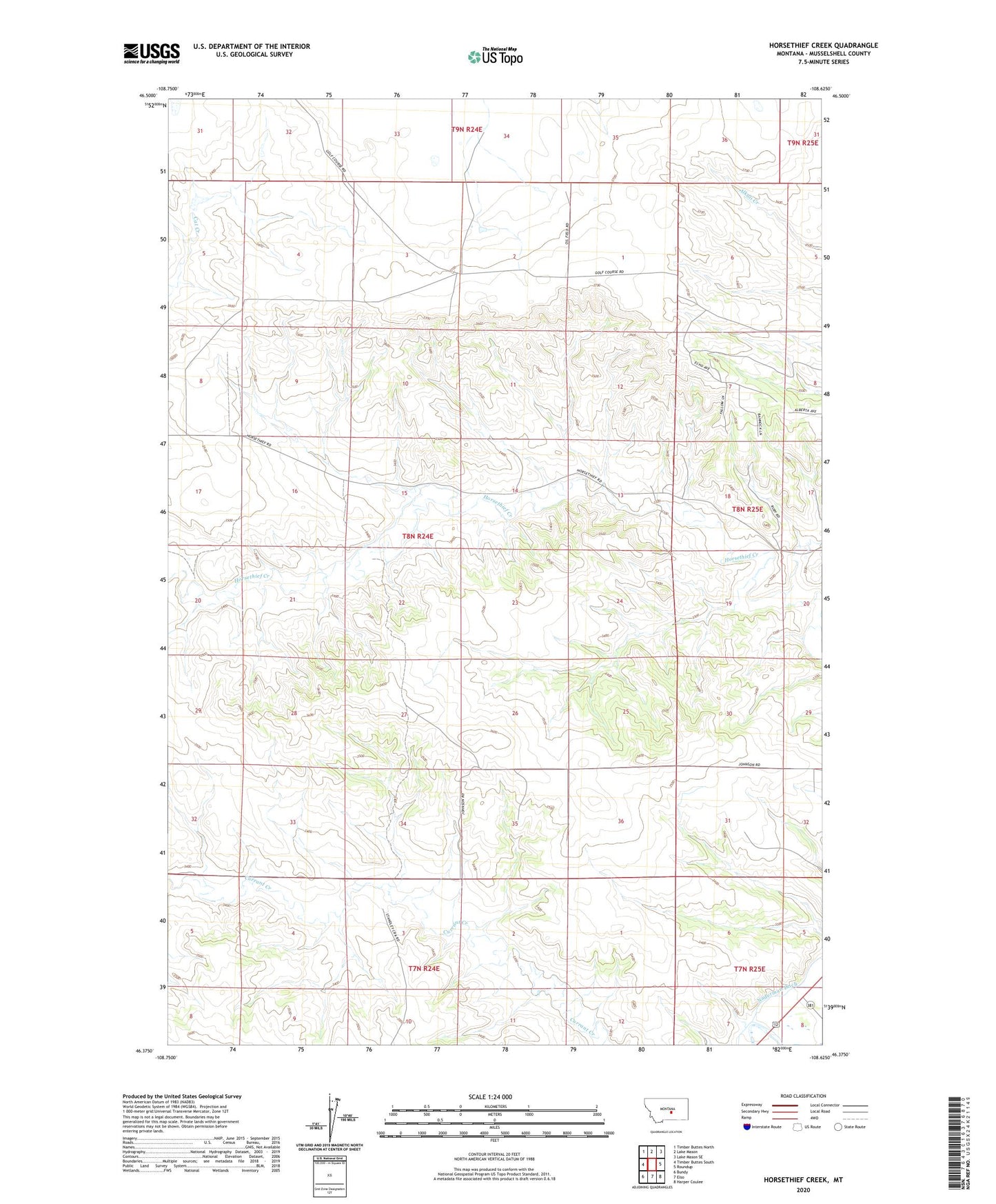
2024 topographic map quadrangle Horsethief Creek in the state of Montana. Scale: 1:24000. Based on the newly updated USGS 7.5' US Topo map series, this map is in the following counties: Musselshell. The map contains contour data, water features, and other items you are used to seeing on USGS maps, but also has updated roads and other features. This is the next generation of topographic maps. Printed on high-quality waterproof paper with UV fade-resistant inks.
Quads adjacent to this one:
West: Timber Buttes South
Northwest: Timber Buttes North
North: Lake Mason
Northeast: Lake Mason SE
East: Roundup
Southeast: Harper Coulee
South: Elso
Southwest: Bundy
This map covers the same area as the classic USGS quad with code o46108d6.
Contains the following named places: 07N24E02BCDA01 Well, 07N24E04BBBC01 Well, 07N25E06ADDD01 Well, 08N24E02C___01 Well, 08N24E15ACCC01 Well, 08N24E15CCBB01 Well, 08N24E17ADD_01 Well, 08N24E17ADDB01 Well, 08N24E20ACBA01 Well, 08N24E33BB__01 Well, 08N25E06BBAD01 Well, 08N25E20BBAD01 Well, Naderman Ditch