MyTopo
Lake Sherburne Montana US Topo Map
Couldn't load pickup availability
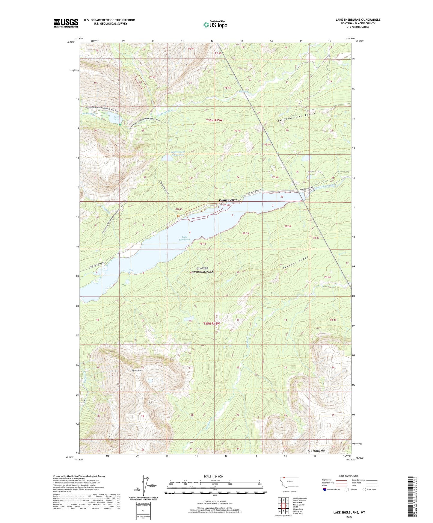
2024 topographic map quadrangle Lake Sherburne in the state of Montana. Scale: 1:24000. Based on the newly updated USGS 7.5' US Topo map series, this map is in the following counties: Glacier. The map contains contour data, water features, and other items you are used to seeing on USGS maps, but also has updated roads and other features. This is the next generation of topographic maps. Printed on high-quality waterproof paper with UV fade-resistant inks.
Quads adjacent to this one:
West: Many Glacier
Northwest: Gable Mountain
North: Chief Mountain
Northeast: Pike Lake
East: Babb
Southeast: Saint Mary
South: Rising Sun
Southwest: Logan Pass
This map covers the same area as the classic USGS quad with code o48113g5.
Contains the following named places: Altyn, Altyn Post Office, Apikuni Creek, Boulder Ridge, Boulder Ridge Trail, Canyon Creek, Cassidy Curve, Cracker Lake Trail, Cutoff Trail, Lake Sherburne, Lake Sherburne Dam, Many Glacier Entrance Station, Poia Lake, Sherburne Post Office, Swiftcurrent Ridge, Swiftcurrent Ridge Lake, Windy Creek, Wynn Mountain