MyTopo
Rising Sun Montana US Topo Map
Couldn't load pickup availability
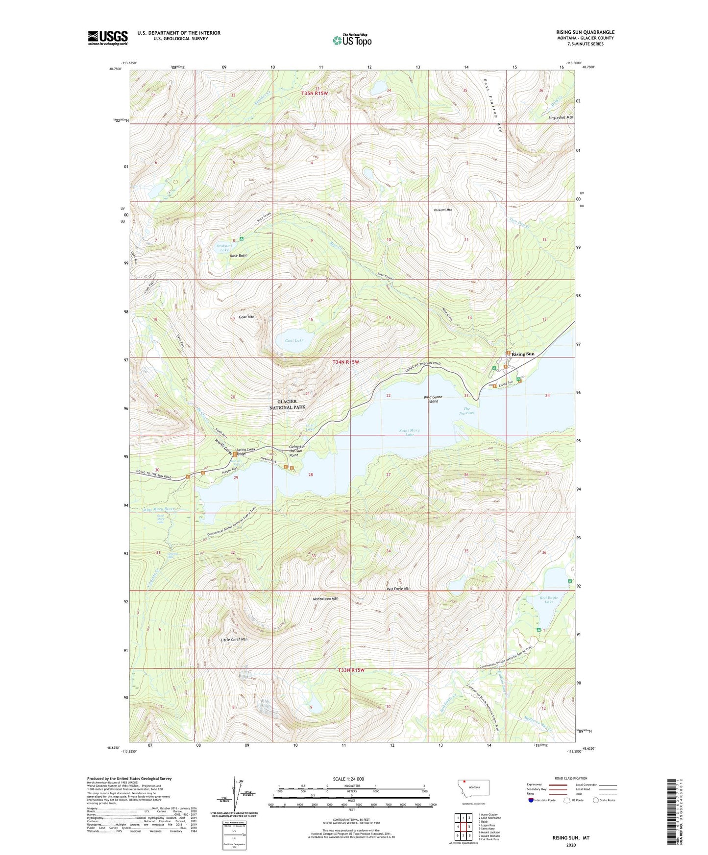
2024 topographic map quadrangle Rising Sun in the state of Montana. Scale: 1:24000. Based on the newly updated USGS 7.5' US Topo map series, this map is in the following counties: Glacier. The map contains contour data, water features, and other items you are used to seeing on USGS maps, but also has updated roads and other features. This is the next generation of topographic maps. Printed on high-quality waterproof paper with UV fade-resistant inks.
Quads adjacent to this one:
West: Logan Pass
Northwest: Many Glacier
North: Lake Sherburne
Northeast: Babb
East: Saint Mary
Southeast: Cut Bank Pass
South: Mount Stimson
Southwest: Mount Jackson
This map covers the same area as the classic USGS quad with code o48113f5.
Contains the following named places: Baring Creek, Baring Creek Bridge, Baring Falls, Dead Horse Point, East Flattop Mountain, Glacier National Park Division, Goat Lake, Goat Mountain, Going-to-the-Sun Point, Golden Stairs, Hudson Bay Creek, Little Chief Mountain, Lost Lake, Mahtotopa Mountain, Many Falls Trail, Medicine Owl Creek, Otokomi Lake, Otokomi Mountain, Red Eagle Lake, Red Eagle Mountain, Rising Sun, Rising Sun Campground, Rose Basin, Rose Creek, Saint Mary Falls, Saint Mary Lake Trail, Silver Dollar Beach, Siyeh Pass Trail, Sunrift Gorge, The Narrows, Virginia Creek, Virginia Falls, Water Ouzel Trail, Wild Goose Island