MyTopo
Logan Pass Montana US Topo Map
Couldn't load pickup availability
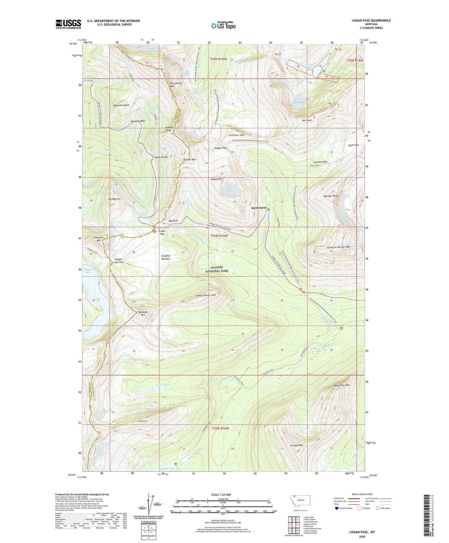
2024 topographic map quadrangle Logan Pass in the state of Montana. Scale: 1:24000. Based on the newly updated USGS 7.5' US Topo map series, this map is in the following counties: Glacier, Flathead. The map contains contour data, water features, and other items you are used to seeing on USGS maps, but also has updated roads and other features. This is the next generation of topographic maps. Printed on high-quality waterproof paper with UV fade-resistant inks.
Quads adjacent to this one:
West: Mount Cannon
Northwest: Ahern Pass
North: Many Glacier
Northeast: Lake Sherburne
East: Rising Sun
Southeast: Mount Stimson
South: Mount Jackson
Southwest: Lake McDonald East
This map covers the same area as the classic USGS quad with code o48113f6.
Contains the following named places: Big Drift, Bird Woman Falls, Bishops Cap, Cataract Mountain, Citadel Mountain, Clements Mountain, Cracker Lake, Cracker Mine, Deadwood Falls, Dusty Star Mountain, Florence Falls, Fusillade Mountain, Gem Glacier, Going-to-the-Sun Mountain, Gunsight Pass Trail, Hanging Gardens, Haystack Butte, Heavy Runner Mountain, Hidden Lake, Hidden Lake Pass, Hidden Lake Trail, Logan Pass, Lunch Creek, Matahpi Peak, Mirror Pond, Morning Eagle Falls, Mount Gould, Mount Oberlin, Mount Siyeh, Oberlin Falls, Piegan Falls, Piegan Glacier, Piegan Mountain, Piegan Pass, Pollock Mountain, Preston Park, Reynolds Creek, Reynolds Mountain, Sexton Glacier, Siyeh Bend, Siyeh Bend Cut-Off Trail, Siyeh Creek, Siyeh Glacier, Siyeh Pass, Triple Arches, Twin Lakes, Weeping Wall