MyTopo
Naismith Montana US Topo Map
Couldn't load pickup availability
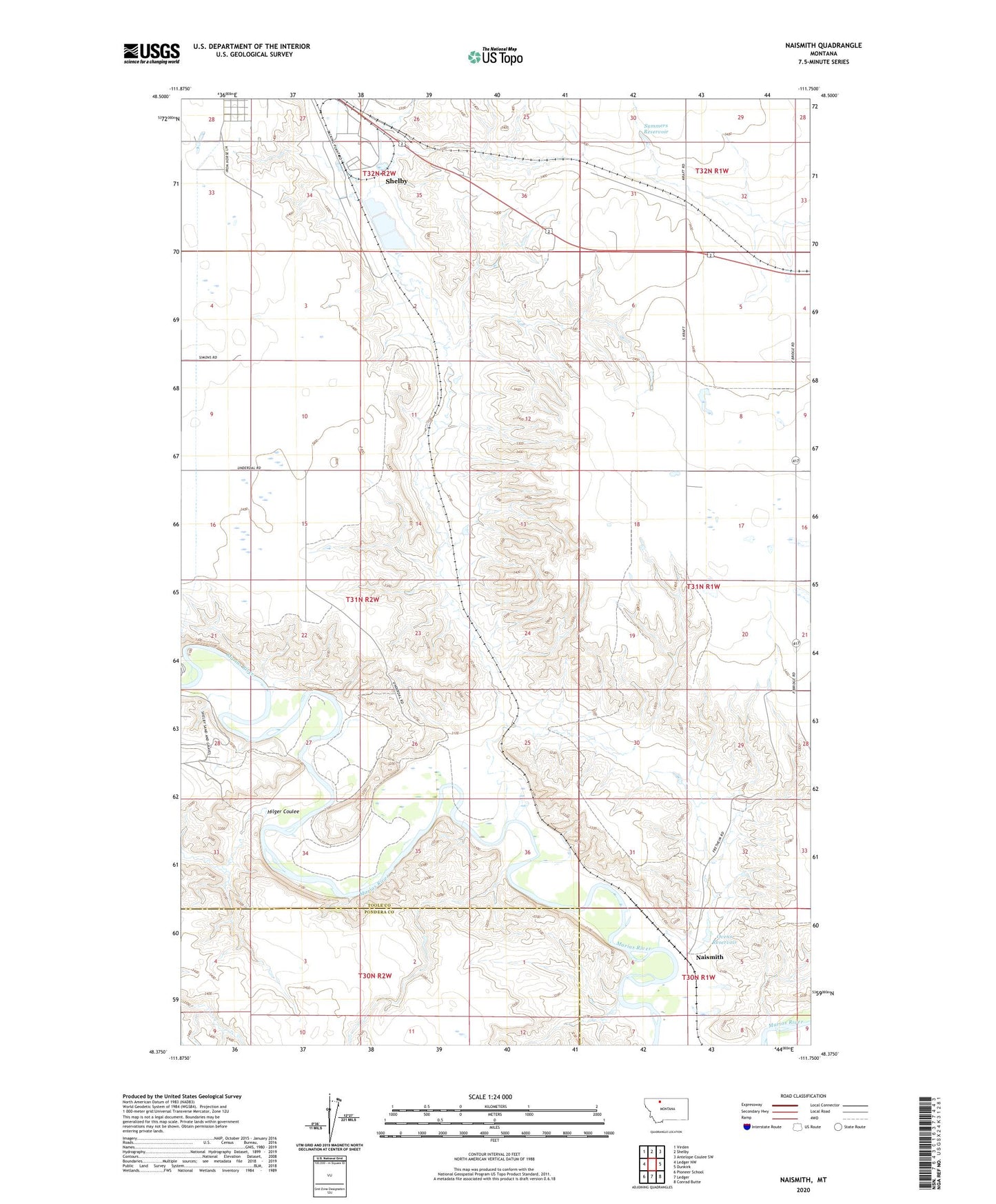
2024 topographic map quadrangle Naismith in the state of Montana. Scale: 1:24000. Based on the newly updated USGS 7.5' US Topo map series, this map is in the following counties: Toole, Pondera. The map contains contour data, water features, and other items you are used to seeing on USGS maps, but also has updated roads and other features. This is the next generation of topographic maps. Printed on high-quality waterproof paper with UV fade-resistant inks.
Quads adjacent to this one:
West: Ledger NW
Northwest: Virden
North: Shelby
Northeast: Antelope Coulee SW
East: Dunkirk
Southeast: Conrad Butte
South: Ledger
Southwest: Pioneer School
This map covers the same area as the classic USGS quad with code o48111d7.
Contains the following named places: 32N02W27DDDD01 Well, Andale, Farrell, Hilger Coulee, Lincoln Park, Marias Fairground, Naismith, Oily Boid Gets the Woim Historical Marker, Ovens Dam, Ovens Reservoir, Roosevelt Park, Shelby Sewage Lagoon Dam, Summers Reservoir, Underdal Ranch, Williamson Park