MyTopo
Ledger NW Montana US Topo Map
Couldn't load pickup availability
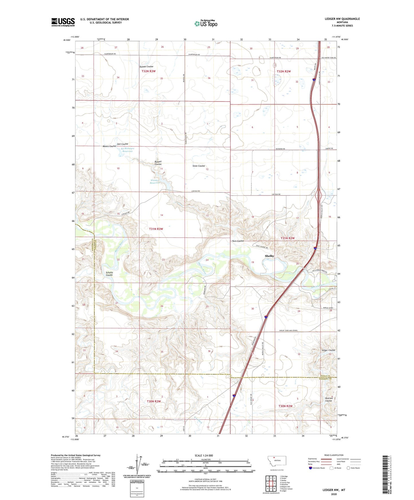
2024 topographic map quadrangle Ledger NW in the state of Montana. Scale: 1:24000. Based on the newly updated USGS 7.5' US Topo map series, this map is in the following counties: Toole, Pondera. The map contains contour data, water features, and other items you are used to seeing on USGS maps, but also has updated roads and other features. This is the next generation of topographic maps. Printed on high-quality waterproof paper with UV fade-resistant inks.
Quads adjacent to this one:
West: Cactus Flat
Northwest: Ethridge
North: Virden
Northeast: Shelby
East: Naismith
Southeast: Ledger
South: Pioneer School
Southwest: Belgian Hill
This map covers the same area as the classic USGS quad with code o48111d8.
Contains the following named places: 31N02W20CDDB01 Well, Aubrey Post, Ed McIntyre Dam, Ed McIntyre Reservoir, KSEN-AM (Shelby), Marias Valley Golf and Country Club, Moore Coulee, Pearson Coulee, Russell Coulee, Schultz Coulee, Snow Coulee, The Moonspinner Dam, Twin Coulee, Wanken Dam, Wanken Reservoir, Williamson Park Campground, Zell Coulee