MyTopo
Lennep Montana US Topo Map
Couldn't load pickup availability
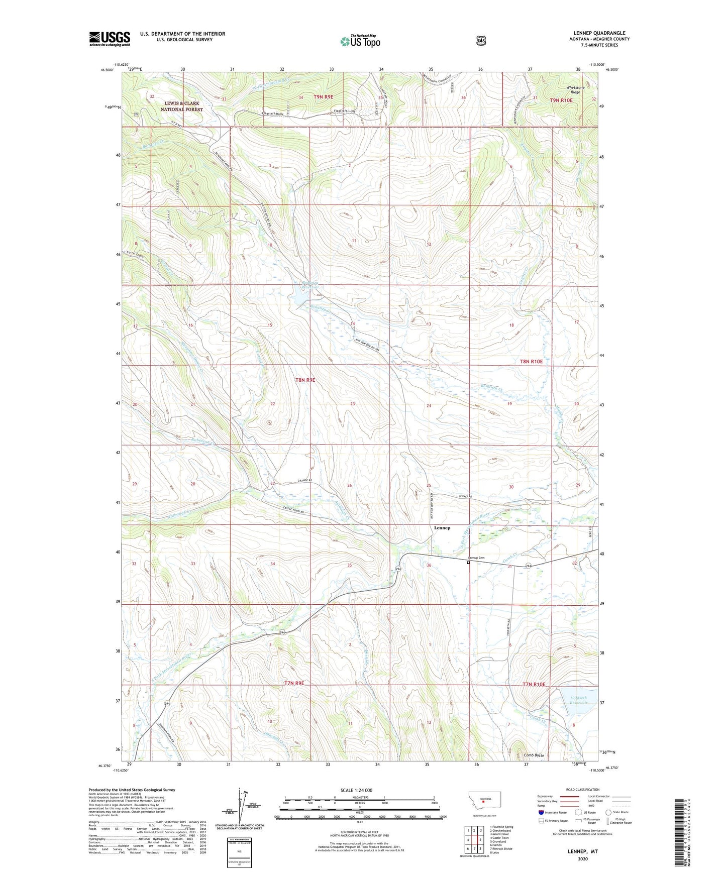
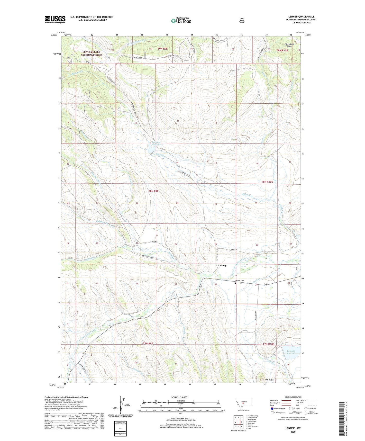
2020 topographic map quadrangle Lennep in the state of Montana. Scale: 1:24000. Based on the newly updated USGS 7.5' US Topo map series, this map is in the following counties: Meagher. The map contains contour data, water features, and other items you are used to seeing on USGS maps, but also has updated roads and other features. This is the next generation of topographic maps. Printed on high-quality waterproof paper with UV fade-resistant inks.
Quads adjacent to this one:
West: Castle Town
Northwest: Fourmile Spring
North: Checkerboard
Northeast: Mount Howe
East: Groveland
Southeast: Lebo
South: Rimrock Divide
Southwest: Hamen
Contains the following named places: 08N10E32____01 Well, Alabaugh Creek, Bonanza, Bonanza Creek, Bonanza Dam, Bonanza Ranch, Bonanza Reservoir, Bozeman Fork Musselshell River, Comb Butte, Comb Creek, Comb Creek School, Corral Creek, Coyote Creek, Deer Creek, Freemans, Lennep, Lennep Elementary School, Lennep Post Office, Lennup Cemetery, Martinsdale-Ringling Division, North Fork Bonanza Creek, Robinson Creek, Sawmill Creek, Slaughter House Creek, South Fork Bonanza Creek, Trinity Lutheran Church, Voldseth Ranch, Voldseth Reservoir, Voldseth West Dam