MyTopo
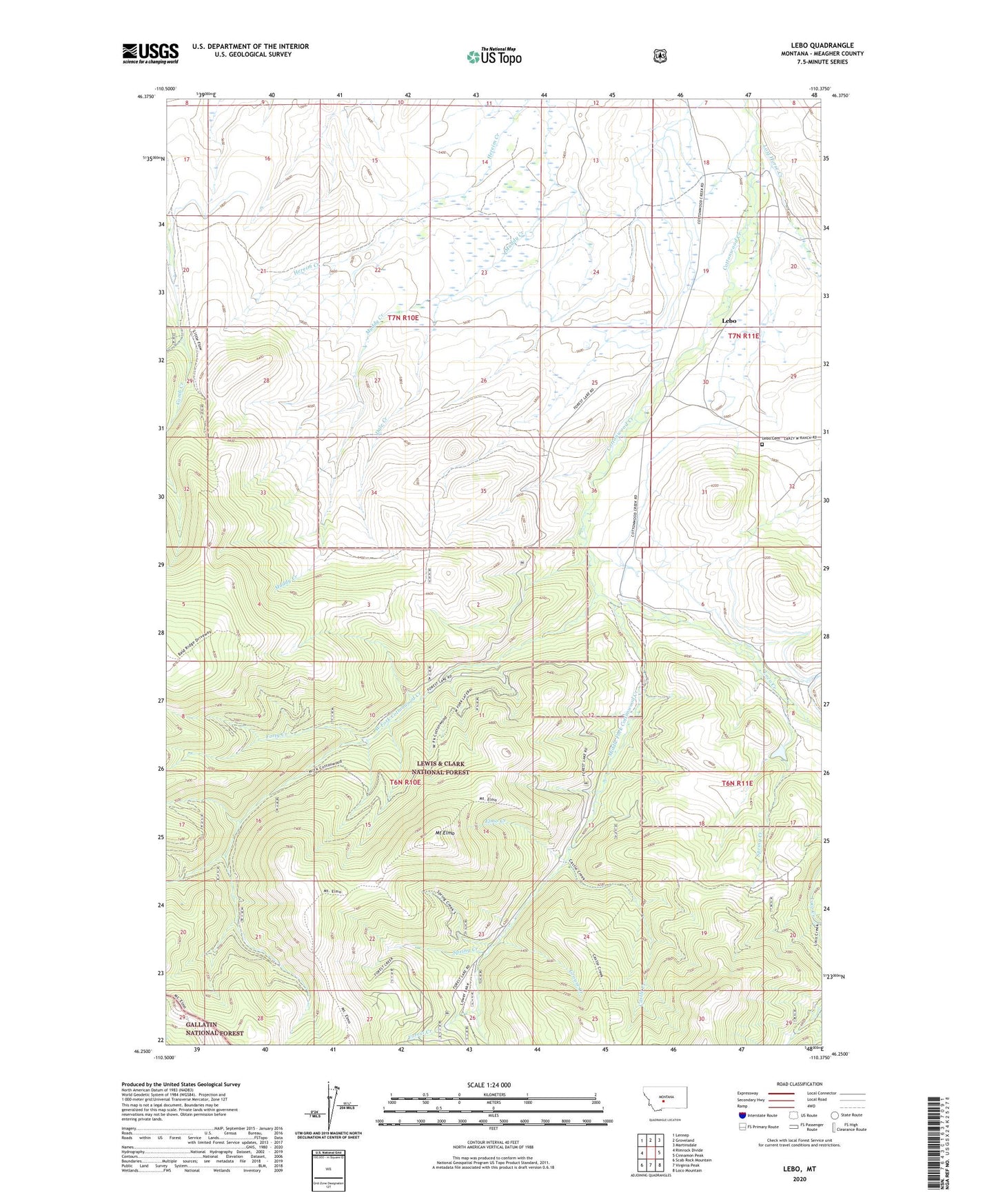
Lebo Montana US Topo Map
Couldn't load pickup availability
Also explore the Lebo Forest Service Topo of this same quad for updated USFS data
2024 topographic map quadrangle Lebo in the state of Montana. Scale: 1:24000. Based on the newly updated USGS 7.5' US Topo map series, this map is in the following counties: Meagher. The map contains contour data, water features, and other items you are used to seeing on USGS maps, but also has updated roads and other features. This is the next generation of topographic maps. Printed on high-quality waterproof paper with UV fade-resistant inks.
Quads adjacent to this one:
West: Rimrock Divide
Northwest: Lennep
North: Groveland
Northeast: Martinsdale
East: Cinnamon Peak
Southeast: Loco Mountain
South: Virginia Peak
Southwest: Scab Rock Mountain
This map covers the same area as the classic USGS quad with code o46110c4.
Contains the following named places: 06N11E06B___01 Well, 06N11E06D___01 Well, 07N11E29____01 Well, Castle Creek, Crazy Sombreo Dam, Dale Creek, Elmo Creek, Forest Creek, Forest Lake Guard Station, Forty Creek, Grouse Creek, Lebo, Lebo Cemetery, Lebo Post Office, Lebo School, Loco Creek, Lost Horse Creek, Lutheran Church, Middle Fork Cottonwood Creek, Mount Elmo, Spring Creek, West Fork Comb Creek, West Fork Cottonwood Creek