MyTopo
Checkerboard Montana US Topo Map
Couldn't load pickup availability
Also explore the Checkerboard Forest Service Topo of this same quad for updated USFS data
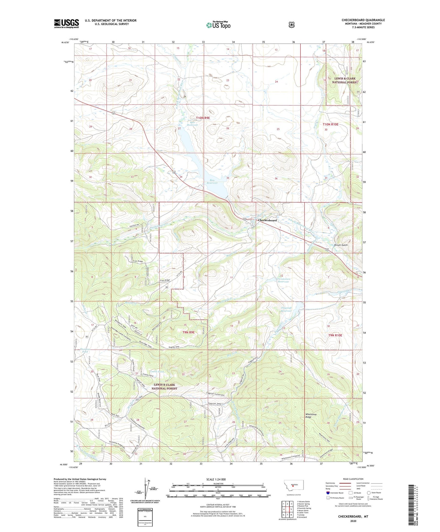
2024 topographic map quadrangle Checkerboard in the state of Montana. Scale: 1:24000. Based on the newly updated USGS 7.5' US Topo map series, this map is in the following counties: Meagher. The map contains contour data, water features, and other items you are used to seeing on USGS maps, but also has updated roads and other features. This is the next generation of topographic maps. Printed on high-quality waterproof paper with UV fade-resistant inks.
Quads adjacent to this one:
West: Fourmile Spring
Northwest: Volcano Butte
North: Hoover Spring
Northeast: Russian Flat
East: Mount Howe
Southeast: Groveland
South: Lennep
Southwest: Castle Town
This map covers the same area as the classic USGS quad with code o46110e5.
Contains the following named places: 09N09E02____01 Well, Bair Dam, Bair Reservoir, Bair Reservoir Sportsmans Access, Brooks Creek, Checkerboard, Checkerboard Creek, Checkerboard School, Christensen Number 1 Dam, Christensen Number 2 Dam, Christensen Reservoir, Coates Pond, Copper Creek, Copperopolis Mine, Delpine Post Office, Delpine School, Dry Fork, Flagstaff Enclosure, Flagstaff Reservoir, Holliday Dam, Orcutt Gulch, Solbergs Pine Valley Cabins, Sourdough Creek, Stohr Creek, SW SW Section 27 Mine, Thorsens Pond, Trail Creek, West Fork Flagstaff Creek