MyTopo
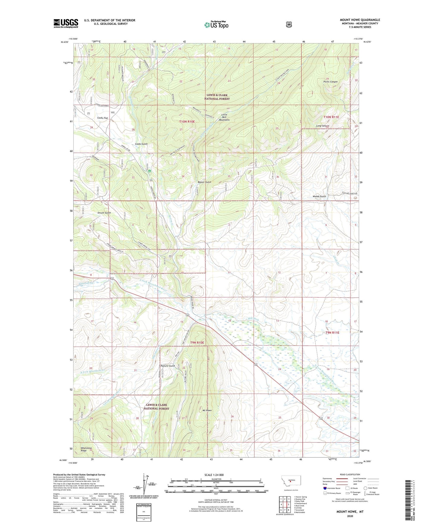
Mount Howe Montana US Topo Map
Couldn't load pickup availability
Also explore the Mount Howe Forest Service Topo of this same quad for updated USFS data
2024 topographic map quadrangle Mount Howe in the state of Montana. Scale: 1:24000. Based on the newly updated USGS 7.5' US Topo map series, this map is in the following counties: Meagher. The map contains contour data, water features, and other items you are used to seeing on USGS maps, but also has updated roads and other features. This is the next generation of topographic maps. Printed on high-quality waterproof paper with UV fade-resistant inks.
Quads adjacent to this one:
West: Checkerboard
Northwest: Hoover Spring
North: Russian Flat
Northeast: Daisy Peak
East: Mud Creek
Southeast: Martinsdale
South: Groveland
Southwest: Lennep
This map covers the same area as the classic USGS quad with code o46110e4.
Contains the following named places: Baxter Gulch, BCE Number 3959 Mine, Clara Burton Mine, Cooks Flat, Cooks Gulch, Cooper Creek, East Fork Spring Creek, Flagstaff Creek, Fort Howie, Holliday Landing Strip, Lou Ire Mine, Mill Ditch, Moonlight Mine, Mount Howe, North Fork Whetstone Creek, Pasture Gulch, South Fork Whetstone Creek, Spring Creek, Spring Creek Campground, West Fork Cooper Creek, Whetstone Creek, Whitetail Creek, Woods Gulch