MyTopo
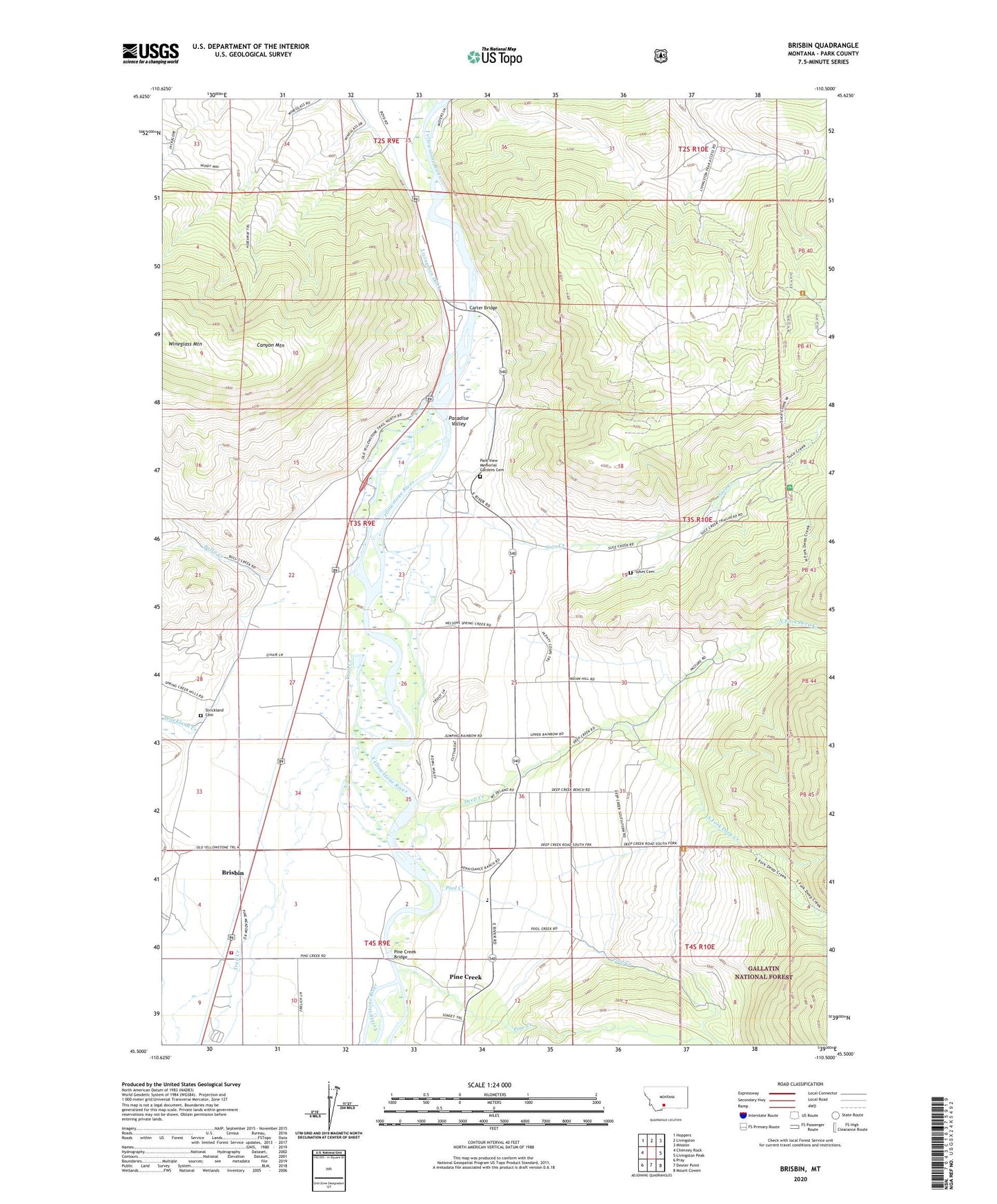
Brisbin Montana US Topo Map
Couldn't load pickup availability
Also explore the Brisbin Forest Service Topo of this same quad for updated USFS data
2024 topographic map quadrangle Brisbin in the state of Montana. Scale: 1:24000. Based on the newly updated USGS 7.5' US Topo map series, this map is in the following counties: Park. The map contains contour data, water features, and other items you are used to seeing on USGS maps, but also has updated roads and other features. This is the next generation of topographic maps. Printed on high-quality waterproof paper with UV fade-resistant inks.
Quads adjacent to this one:
West: Chimney Rock
Northwest: Hoppers
North: Livingston
Northeast: Mission
East: Livingston Peak
Southeast: Mount Cowen
South: Dexter Point
Southwest: Pray
This map covers the same area as the classic USGS quad with code o45110e5.
Contains the following named places: Allens Spur, Brisbin, Bullis Creek, Carter Bridge, Carters Bridge Fishing Access Site, Carters Bridge Recreation Site, Deep Creek, Deep Creek Ranger Station, Deep Creek School, Free River Fishing Access Site, Granite Gate, Lime Kiln, Livingston/Paradise Valley KOA, North Fork Deep Creek, Paradise Valley, Paradise Valley Community Hall, Park Branch Canal, Park View Memorial Gardens Cemetery, Pine Creek, Pine Creek Bridge, Pine Creek Census Designated Place, Pine Creek Church, Pine Creek Ditch, Pine Creek Fishing Access Site, Pine Creek School, Pinecreek Post Office, Pool Creek, Richland Post Office, Richland School, Rock Canyon RV Park, South Fork Deep Creek, Spring Creek Ditch, Strickland Cemetery, Strickland Creek, Suce Creek, Suce Creek School, Sykes Cemetery, Trail Creek, Trowbridge Ranch, ZIP Code: 59047