MyTopo
Lost Creek Montana US Topo Map
Couldn't load pickup availability
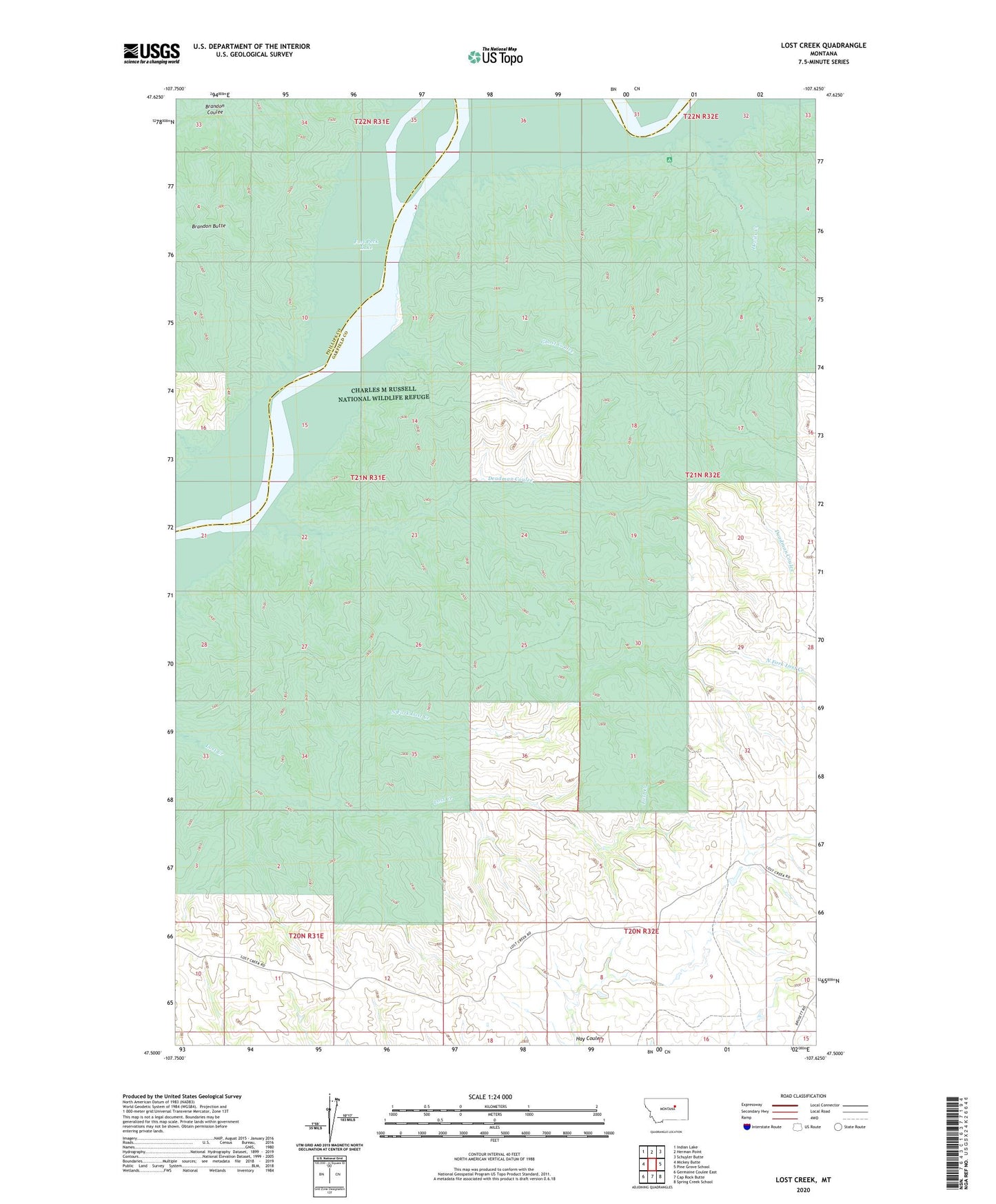
2020 topographic map quadrangle Lost Creek in the state of Montana. Scale: 1:24000. Based on the newly updated USGS 7.5' US Topo map series, this map is in the following counties: Garfield, Phillips. The map contains contour data, water features, and other items you are used to seeing on USGS maps, but also has updated roads and other features. This is the next generation of topographic maps. Printed on high-quality waterproof paper with UV fade-resistant inks.
Quads adjacent to this one:
West: Mickey Butte
Northwest: Indian Lake
North: Herman Point
Northeast: Schuyler Butte
East: Pine Grove School
Southeast: Spring Creek School
South: Cap Rock Butte
Southwest: Germaine Coulee East
Contains the following named places: 24N31E34CC__01 Well, Brandon Butte, Bronze Dam, Deadman Coulee, Devils Creek, Devils Creek Campground, Devils Creek State Recreation Area, Ghost Coulee, Lost Creek, North Fork Lost Creek