MyTopo
Hauser Lake Montana US Topo Map
Couldn't load pickup availability
Also explore the Hauser Lake Forest Service Topo of this same quad for updated USFS data
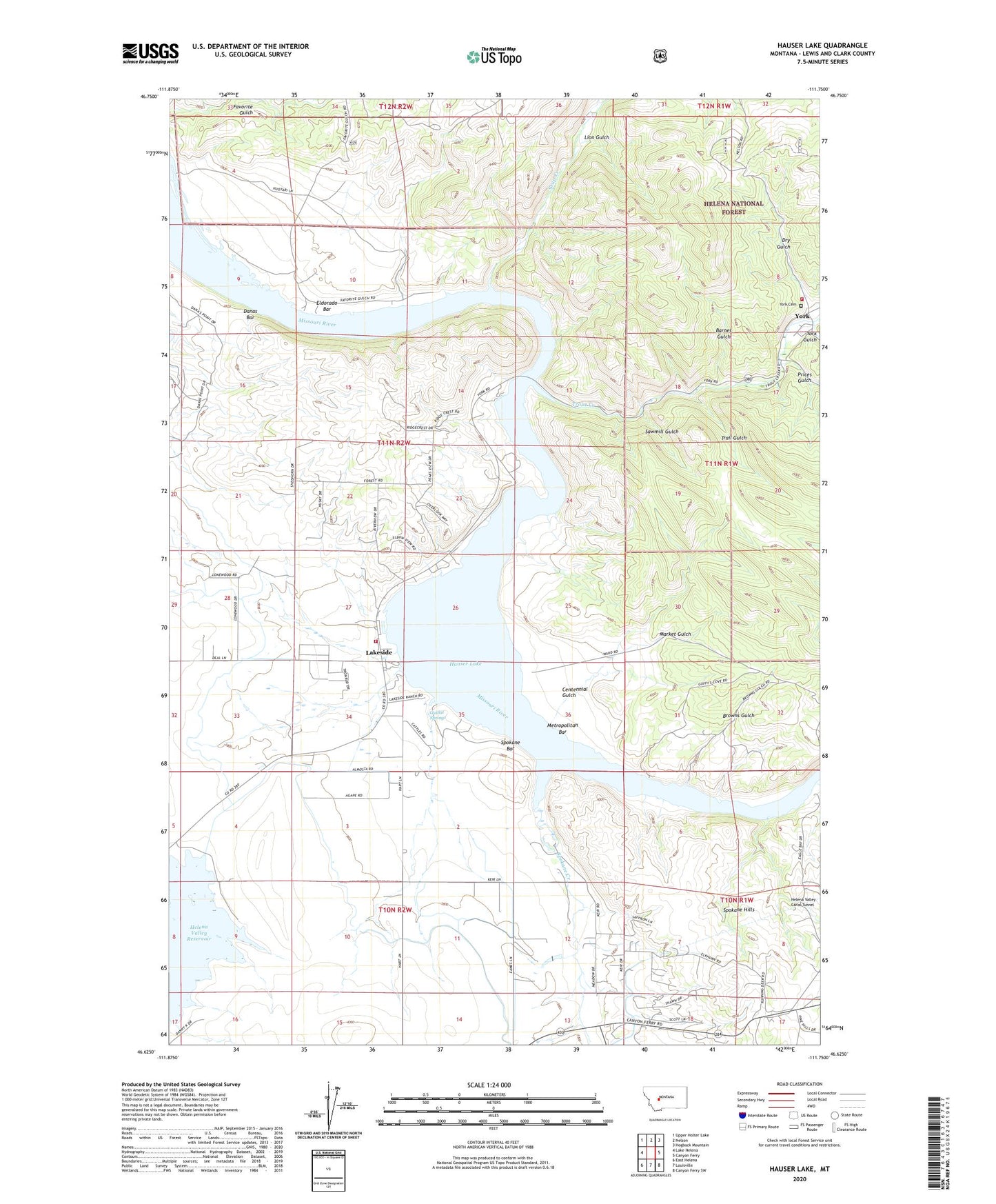
2024 topographic map quadrangle Hauser Lake in the state of Montana. Scale: 1:24000. Based on the newly updated USGS 7.5' US Topo map series, this map is in the following counties: Lewis and Clark. The map contains contour data, water features, and other items you are used to seeing on USGS maps, but also has updated roads and other features. This is the next generation of topographic maps. Printed on high-quality waterproof paper with UV fade-resistant inks.
Quads adjacent to this one:
West: Lake Helena
Northwest: Upper Holter Lake
North: Nelson
Northeast: Hogback Mountain
East: Canyon Ferry
Southeast: Canyon Ferry SW
South: Louisville
Southwest: East Helena
This map covers the same area as the classic USGS quad with code o46111f7.
Contains the following named places: 10N02W04CDDC01 Well, 11N02W23CDDD01 Well, 11N02W26BADA01 Well, 11N02W26BBDC01 Well, Barnes Gulch, Brooklyn, Browns Gulch, Centennial Gulch, Danas Bar, Downieville Post Office, Dry Gulch, El Dorado, Eldorado Bar, Eldorado Strip Mine, French Bar Post Office, Golden Charm Mine, Guillot Springs, Hauser Lake, Helena Valley Canal Tunnel, Lakeside, Lakeside Resort, Lakeside School, Lion Gulch, Lonewood Meadows Airport, Market Gulch, Marlo, Metropolitan Bar, Mountain Lakes Field Airport, N Section 5 Prospects Mine, Prices Gulch, Sawmill Gulch, Soup Creek, Spokane Bar, Spokane Creek, Stubbs Ferry, Trail Gulch, Tri - Lakes Volunteer Fire Department Station 2, Trout Creek, York, York Bridge Fishing Access Site, York Cemetery, York Census Designated Place, York Gulch, York Post Office, York School, York Volunteer Fire Department