MyTopo
Martinsdale Montana US Topo Map
Couldn't load pickup availability
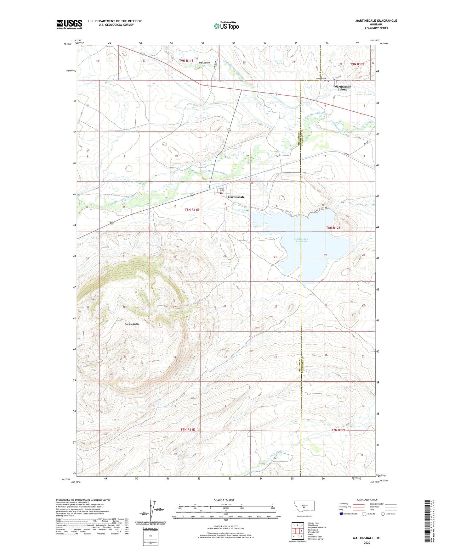
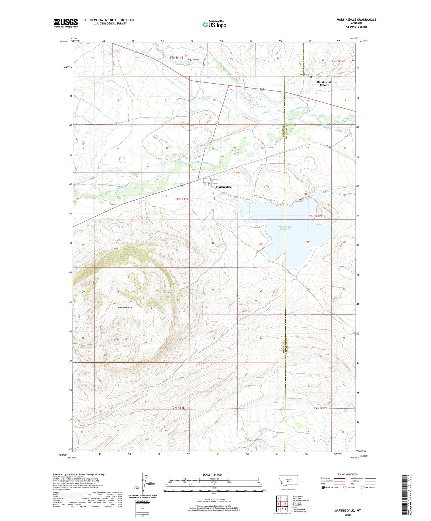
2020 topographic map quadrangle Martinsdale in the state of Montana. Scale: 1:24000. Based on the newly updated USGS 7.5' US Topo map series, this map is in the following counties: Meagher, Wheatland. The map contains contour data, water features, and other items you are used to seeing on USGS maps, but also has updated roads and other features. This is the next generation of topographic maps. Printed on high-quality waterproof paper with UV fade-resistant inks.
Quads adjacent to this one:
West: Groveland
Northwest: Mount Howe
North: Mud Creek
Northeast: Haymaker Ranch SW
East: Twodot NW
Southeast: Cinnamon Spring
South: Cinnamon Peak
Southwest: Lebo
Contains the following named places: 08N11E11____01 Well, 08N11E14____01 Well, 08N11E14D___01 Well, 09N11E34C___01 Well, Big Coulee, Charles M Bair Family Museum, Clendennin School, East Martinsdale Dam, Gauglersville, Gauglerville Cemetery, Gauglerville School, Gillis Creek, Gordon Butte, Martinsdale, Martinsdale Census Designated Place, Martinsdale Colony, Martinsdale Colony Census Designated Place, Martinsdale Colony School, Martinsdale Fire Station, Martinsdale Post Office, Martinsdale Reservoir, Martinsdale Reservoir Fishing Access Site, Martinsdale School, North Fork Musselshell River, North Martinsdale Dam, South Fork Musselshell River, Third Stooges Dam