MyTopo
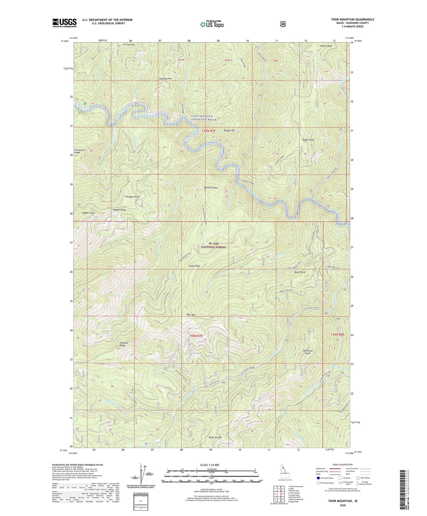
Thor Mountain Idaho US Topo Map
Couldn't load pickup availability
Also explore the Thor Mountain Forest Service Topo of this same quad for updated USFS data
2024 topographic map quadrangle Thor Mountain in the state of Idaho. Scale: 1:24000. Based on the newly updated USGS 7.5' US Topo map series, this map is in the following counties: Shoshone. The map contains contour data, water features, and other items you are used to seeing on USGS maps, but also has updated roads and other features. This is the next generation of topographic maps. Printed on high-quality waterproof paper with UV fade-resistant inks.
Quads adjacent to this one:
West: Three Sisters
Northwest: Shefoot Mountain
North: Adair
Northeast: McGee Peak
East: Conrad Peak
Southeast: Peggy Peak
South: Bathtub Mountain
Southwest: Montana Peak
This map covers the same area as the classic USGS quad with code o47115b5.
Contains the following named places: Adams Peak, Bad Luck Creek, Bennett Creek, Bennett Point, Bluff Point, Bottle Creek, Bullet Creek, Dominion Point, Eagle Creek, Eagle Point, East Fork Bluff Creek, Fuzzy Creek, Fuzzy Peak, Halfway Hill, Hardpan Creek, Hardpan Point, Malin Creek, Nugget Creek, Nugget Hill, Nugget Point, Periwinkle Creek, Prospector Creek, Quartz Creek, Siamese Creek, Thor Mountain, Tin Can Creek, Tin Can Flat Campground, West Fork Bluff Creek, Whistling Creek