MyTopo
Whitcomb Peak Montana US Topo Map
Couldn't load pickup availability
Also explore the Whitcomb Peak Forest Service Topo of this same quad for updated USFS data
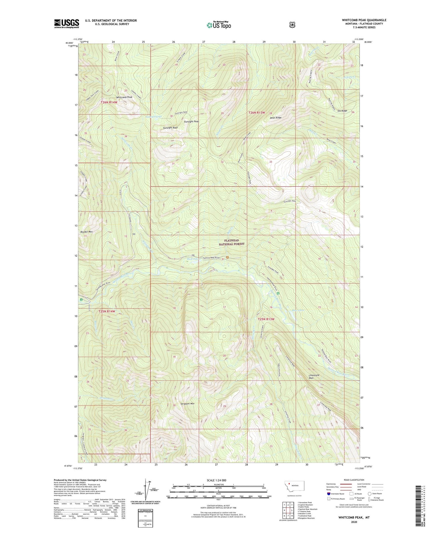
2024 topographic map quadrangle Whitcomb Peak in the state of Montana. Scale: 1:24000. Based on the newly updated USGS 7.5' US Topo map series, this map is in the following counties: Flathead. The map contains contour data, water features, and other items you are used to seeing on USGS maps, but also has updated roads and other features. This is the next generation of topographic maps. Printed on high-quality waterproof paper with UV fade-resistant inks.
Quads adjacent to this one:
West: Spotted Bear Mountain
Northwest: Horseshoe Peak
North: Capitol Mountain
Northeast: Gable Peaks
East: Trilobite Peak
Southeast: Bungalow Mountain
South: Cathedral Peak
Southwest: Meadow Creek
This map covers the same area as the classic USGS quad with code o47113h3.
Contains the following named places: Beaver Creek, Beaver Creek Campground, Big Bill Mountain, Blue Lakes, Dean Ridge, Deer Creek, Gunsight Lake, Gunsight Peak, Gunsight Rock, Gunsight Trail, Limestone Wall, Milk Creek, Sergeant Mountain, Shelf Lake, Silvertip Creek, Silvertip Guard Station, Spotted Bear Schafer Trail, West Fork Schafer Creek, Whitcomb Creek, Whitcomb Peak