MyTopo
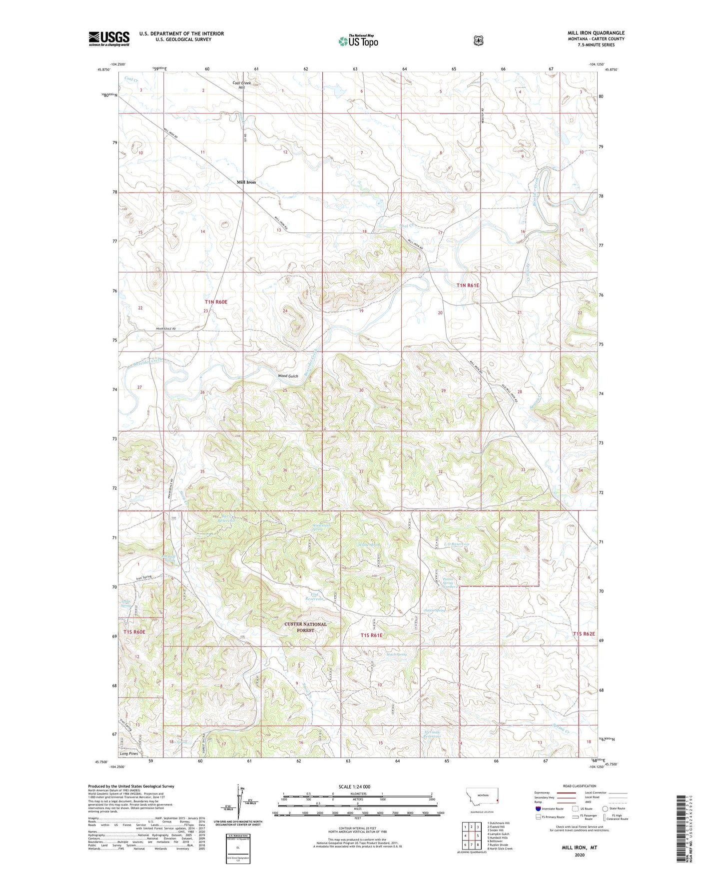
Mill Iron Montana US Topo Map
Couldn't load pickup availability
2020 topographic map quadrangle Mill Iron in the state of Montana. Scale: 1:24000. Based on the newly updated USGS 7.5' US Topo map series, this map is in the following counties: Carter. The map contains contour data, water features, and other items you are used to seeing on USGS maps, but also has updated roads and other features. This is the next generation of topographic maps. Printed on high-quality waterproof paper with UV fade-resistant inks.
Quads adjacent to this one:
West: Lampkin Gulch
Northwest: Dutchmans Hill
North: Flasted Hill
Northeast: Snider Hill
East: Humbolt Hills
Southeast: North Slick Creek
South: Rustler Divide
Southwest: Belltower
Contains the following named places: 01N60E34CDDD01 Well, 01N61E08BCDA01 Well, 01N61E29ADAB01 Well, 01N61E32BDBD01 Well, 01S61E03ABAB01 Well, Arledge Well, Bar C Reservoir, Byrne Well, Coal Creek, Coal Creek School, Flat Reservoir, Hatch Spring, Herman Reservoir, Iron Spring, L O Reservoir, Latham Well, Lower Snow Creek Well, McNary School, Mill Iron, Mill Iron Post Office, Old Snow Creek Well, Patton Spring, Patton Spring Number 2, Pine Hill School, Red Bluff Spring, Saint Ann Church, Set Inc Number 1 Dam, Snow Creek, Spring Creek, Wallenstein Dam, Willow Spring, Wood Gulch, Wood Gulch Spring, Wood Gulch Well