MyTopo
Dutchmans Hill Montana US Topo Map
Couldn't load pickup availability
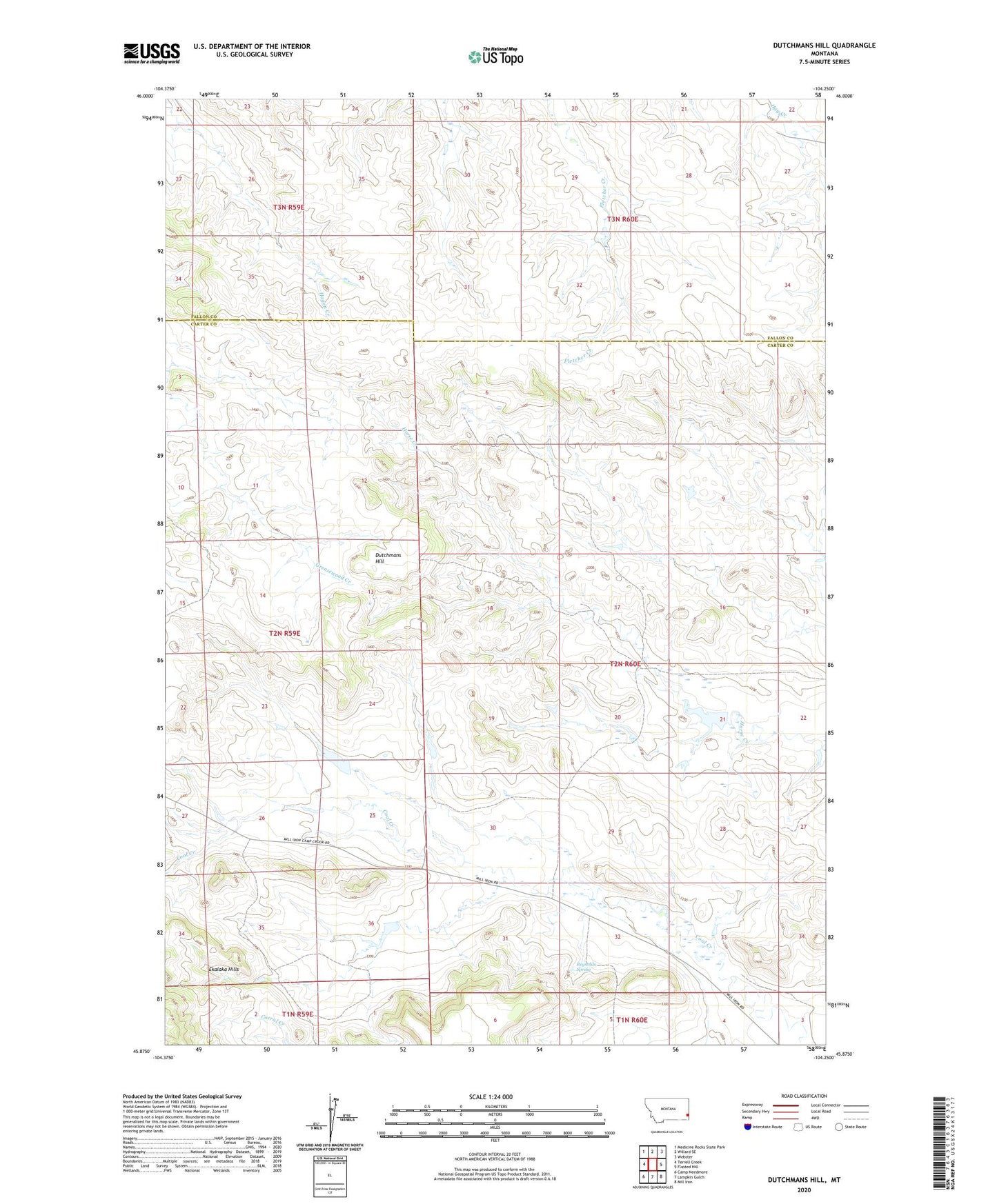
2024 topographic map quadrangle Dutchmans Hill in the state of Montana. Scale: 1:24000. Based on the newly updated USGS 7.5' US Topo map series, this map is in the following counties: Carter, Fallon. The map contains contour data, water features, and other items you are used to seeing on USGS maps, but also has updated roads and other features. This is the next generation of topographic maps. Printed on high-quality waterproof paper with UV fade-resistant inks.
Quads adjacent to this one:
West: Terrell Creek
Northwest: Medicine Rocks State Park
North: Willard SE
Northeast: Webster
East: Flasted Hill
Southeast: Mill Iron
South: Lampkin Gulch
Southwest: Camp Needmore
This map covers the same area as the classic USGS quad with code o45104h3.
Contains the following named places: 02N60E17BCDC01 Well, Dutchmans Hill, Jardee Dam, Nies Dam, Reynolds Spring