MyTopo
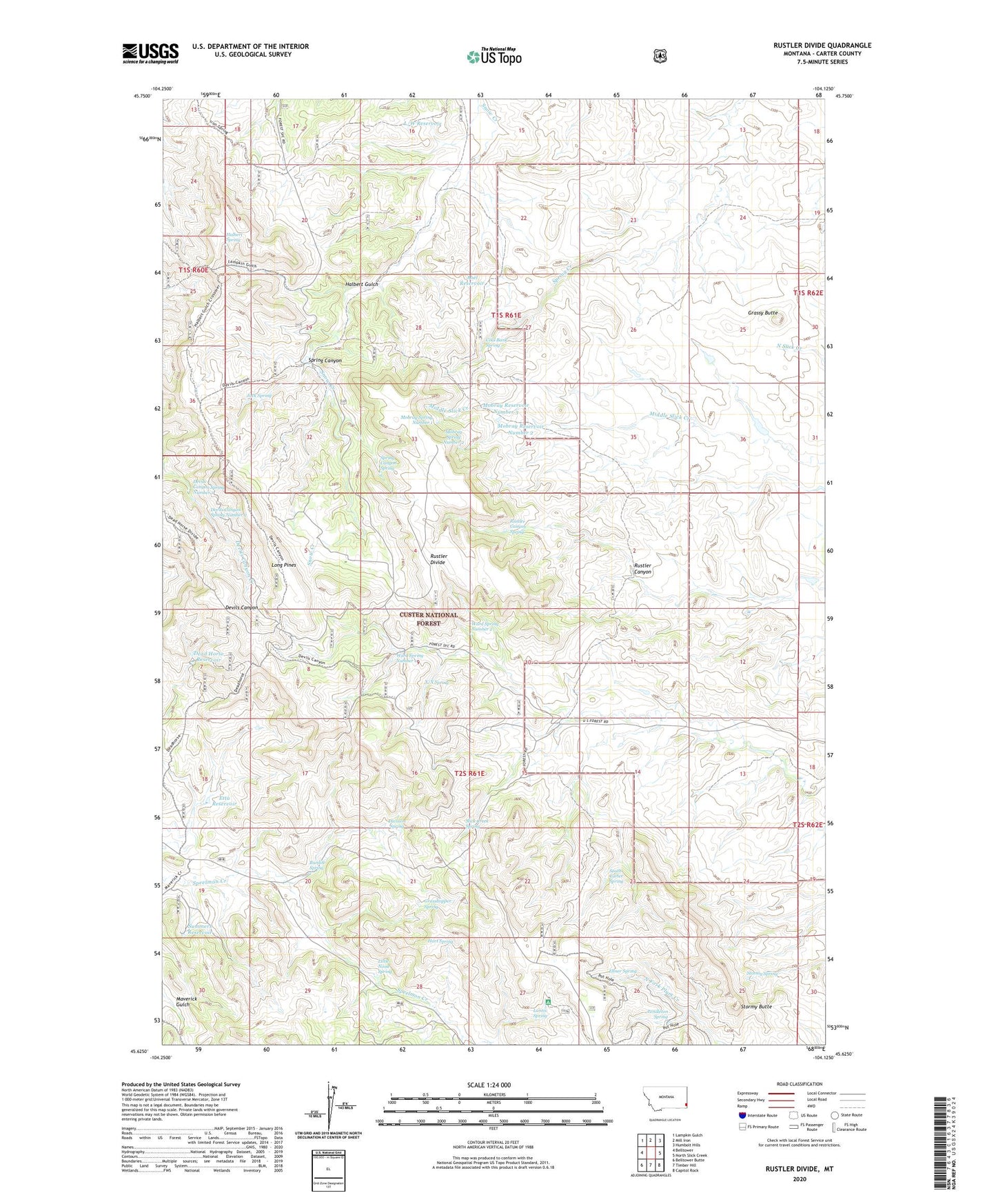
Rustler Divide Montana US Topo Map
Couldn't load pickup availability
Also explore the Rustler Divide Forest Service Topo of this same quad for updated USFS data
2024 topographic map quadrangle Rustler Divide in the state of Montana. Scale: 1:24000. Based on the newly updated USGS 7.5' US Topo map series, this map is in the following counties: Carter. The map contains contour data, water features, and other items you are used to seeing on USGS maps, but also has updated roads and other features. This is the next generation of topographic maps. Printed on high-quality waterproof paper with UV fade-resistant inks.
Quads adjacent to this one:
West: Belltower
Northwest: Lampkin Gulch
North: Mill Iron
Northeast: Humbolt Hills
East: North Slick Creek
Southeast: Capitol Rock
South: Timber Hill
Southwest: Belltower Butte
This map covers the same area as the classic USGS quad with code o45104f2.
Contains the following named places: 01S61E20CAAA01 Well, Abel Reservoir, Burditt Spring, Carter Well, Coal Bank Spring, Dead Horse Reservoir, Devils Canyon Spring Number 1, Devils Canyon Spring Number 2, Division Spring, Elmer Spring, Etta Reservoir, Grasshopper Spring, Grassy Butte, Halbert Gulch, Halbert Spring, Hart Spring, Jack Spring, Kennedy Well, L/W Reservoir, Lantis Spring, Lantis Spring Campground, Little Noise Spring, Long Pines, Milo Well, Mobray Reservoir Number 2, Mobray Reservoir Number 3, Mobray Spring Number 1, Mobray Spring Number 2, Mowbray Number 3 Dam, Pendleton Spring, Rustler Canyon, Rustler Canyon Spring, Rustler Divide, Slick Creek Spring, South Carter Spring, Spring Canyon, Spring Canyon Spring, Stieg Well, Stormy Butte, Stormy Spring, Summers Reservoir, Tarter Well, Tri Point Tower, Ward Spring Number 1, Ward Spring Number 2, X/X Spring