MyTopo
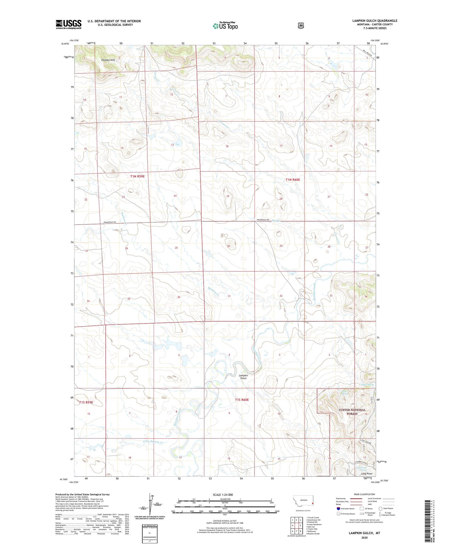
Lampkin Gulch Montana US Topo Map
Couldn't load pickup availability
Also explore the Lampkin Gulch Forest Service Topo of this same quad for updated USFS data
2024 topographic map quadrangle Lampkin Gulch in the state of Montana. Scale: 1:24000. Based on the newly updated USGS 7.5' US Topo map series, this map is in the following counties: Carter. The map contains contour data, water features, and other items you are used to seeing on USGS maps, but also has updated roads and other features. This is the next generation of topographic maps. Printed on high-quality waterproof paper with UV fade-resistant inks.
Quads adjacent to this one:
West: Camp Needmore
Northwest: Terrell Creek
North: Dutchmans Hill
Northeast: Flasted Hill
East: Mill Iron
Southeast: Rustler Divide
South: Belltower
Southwest: Taylor Hills
This map covers the same area as the classic USGS quad with code o45104g3.
Contains the following named places: 01N60E19DBDA01 Well, 01N60E22CAB_01 Well, 01S60E04CDDB01 Well, 01S60E08ACBC01 Well, Arpan Spring, Corral Creek, German Number 3 Dam, German Number 9 Dam, Harmon Creek, Lampkin Gulch, Last Chance Spring, Little Ramme Creek, Mud Creek, Neece Spring, Setine Dam, Staats Post Office